Full-time work at Backcountry will resume at the end of the month, but in the mean time here are two more photos from the recent La Jolla trip:
"My life amounts to no more than one drop in a limitless ocean. Yet what is any ocean, but a multitude of drops?" — David Mitchell
Full-time work at Backcountry will resume at the end of the month, but in the mean time here are two more photos from the recent La Jolla trip:


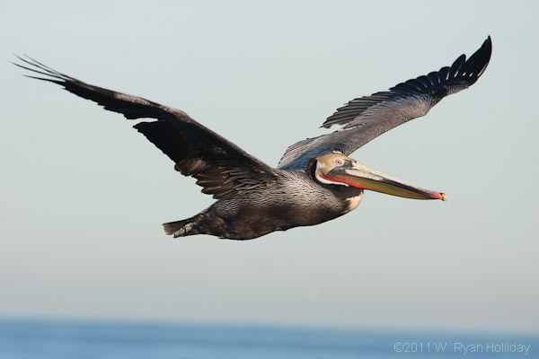
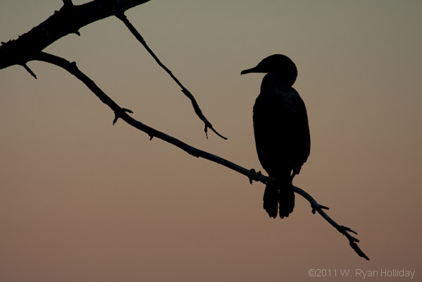
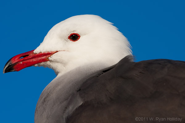
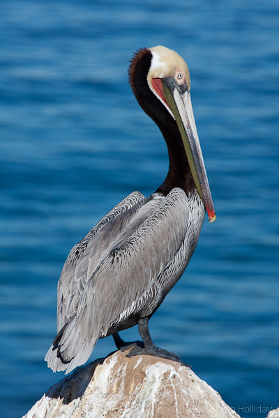
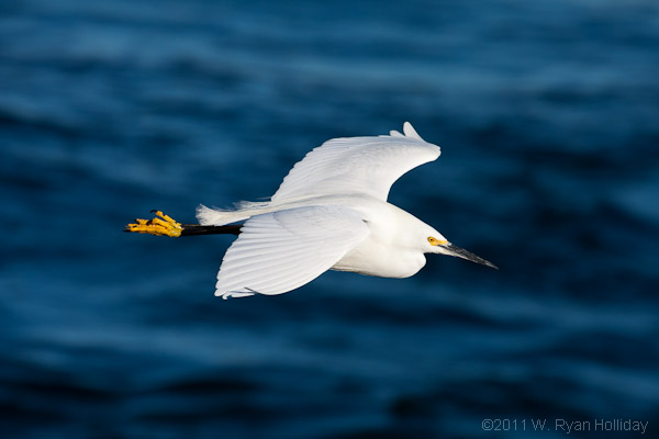
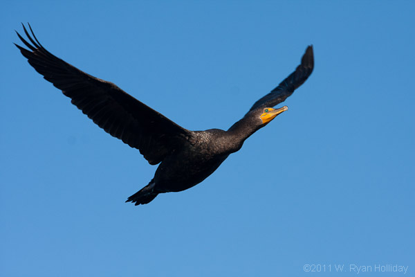
I spent yesterday and today in La Jolla attempting to photograph birds since it’s a good time of year for animals, hotel rates are distressingly low, I am at least temporarily my own boss, and an occasional trip to La Jolla is just plain old good sense. After about three hundred photos of seabirds in flight my talent for taking pictures of headless, blurry birds has been re-affirmed; call if you are in need of that skillset.
Having never been to La Jolla expectations were limited, but the town is now high on the list of places to visit regularly. Between seals, sea lions, pelicans, cormorants, gulls, and even a peregrine falcon there was a massive amount of wildlife on display. The photographs below are a handful of the keepers from the trip. Special thanks to Phillip Colla, someone I’ve never actually met but whose guide to photographing pelicans in La Jolla inspired the short road trip.
A lack of internet access and free time over the past couple of days prevented journal entries. Here’s the recap:
Monday
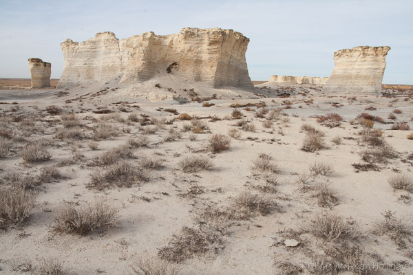
The 500 mile drive from Greensburg, Kansas to Vail, Colorado led through Dodge City, past the slightly-odd Monument Rocks in west-central Kansas, and on to Denver for a quick visit with Scott & Anna of Accenture, San Francisco and Galapagos fame. Following Scott’s house tour (“we don’t even use this room”), a demo of his Evel Knievel Halloween getup, and some bemused looks from Anna, I headed off into a snowstorm and the pants-crapping drive on dark and snowy I-70 through Vail Pass at an elevation of 10,666 feet.
Tuesday
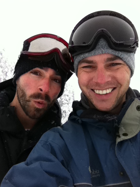
Vail is a ridiculously good place to ski. It’s been about six years since the last time I was on the slopes so I wasn’t quite prepared for what was about to happen, but this resort was insane – the runs were more than twice as long as anything I’ve ever done before, the skiing conditions were outrageously good, and with Aaron’s employee discounts the costs were tolerable. I managed to mostly not die, even though at one point our attempt to ski the “In the Wuides” trail resulted in a wrong turn that actually took us in the woods; navigating trees and boulders in three foot deep powder is a bit more than this novice was prepared for, but in the end we emerged alive and my quads should be recovered by some time in mid-2011. A tremendously good day by any measure.
Wedneday
After breakfast with Aaron I left Vail at 8AM – LA was 934 miles away, and, since weather on this trip has been an ongoing challenge, it was only fitting that flooding was taking place in the parts of Utah, Arizona, Nevada and California that I would be driving through. It was a bit surreal hearing national news stories on the radio about flooded areas, only to be passing them as I was driving – the trees in New Harmony, Utah were under 10-15 of water as I went by – but overall it was a mostly uneventful drive that ended after fourteen hours with a return to Culver City and an end to a very good trip.
Yesterday in brief:
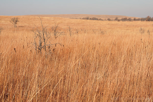
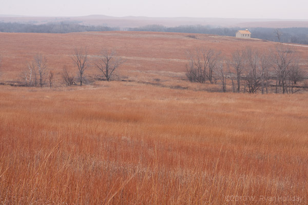
The tiniest bit of sun would have made today a great photo day – the tallgrass prairie is really pretty – but unfortunately Mother Nature had other plans. Despite the overcast the day was a good one for hiking, and eight miles of roaming allowed tons of time for reflection. A resolution for 2011 may be to make an effort to do at least one long hike a month, ’cause it’s a mighty good way to sort out what few thoughts my working neurons generate.
After a day on the prairie enjoying the scenery and the company of hawks and eagles, the plan is to do more of the same tomorrow across the border in Oklahoma. It turns out that the Nature Conservancy owns most of the land on which the Tallgrass Prairie National Preserve sits, as well as a larger preserve in Oklahoma, so it’s encouraging to see where support for this organization is going.
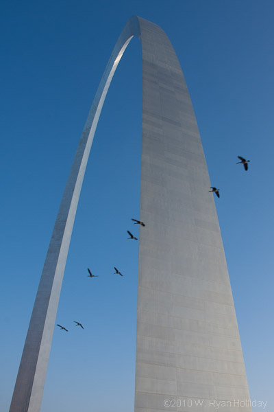
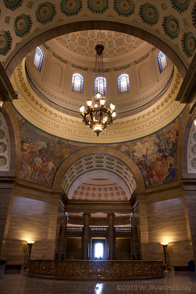
The great expedition of discovery to Kansas was pushed back a day – instead I spent a chilly and icy morning slipping on the walkways near the Gateway Arch and the Jefferson National Expansion Memorial in St. Louis, followed by a drive across the rest of the Show Me state. After a mid-morning departure from St. Louis the state’s backroads led to the capital of Jefferson City, so I detoured and explored what turned out to be an amazing Capitol building that was almost completely open to the public – maybe it’s because the state government is on holiday break, but there were no security checks and no one seemed to mind that a slightly hairy, fairly smelly 35 year old was roaming the halls.
The afternoon led on a roundabout tour past the distressingly touristy Lake of the Ozarks – I quit counting after the fifth go-cart course and ten millionth houseboat – and this journal entry is being made from a Starbucks at the state’s western edge, just outside of Kansas City. The plan for the rest of the night and tomorrow includes heading into Kansas to try and find a place to park the Subaru for the evening, followed by a morning visit to the Tallgrass Prairie National Preserve. After that it’s anyone’s guess what other wonders the amazing Sunflower state might have to offer.
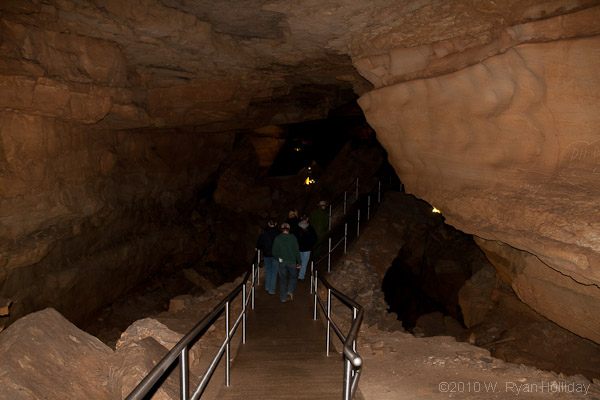
It turns out that weekdays in December are a ridiculously good time to visit Mammoth Cave. The Frozen Niagara Tour and the Historic Tour had “participant limits” of 36 and 110 people, respectively, but only five people were on each tour today. According to the ranger who led the first tour, they get 5000 people a day during the summer, and the day after Labor Day that number immediately drops to 300 per day. Today there were perhaps 30 people in the park.
My love of spelunking is well documented, and today continued that proud tradition. I probably would have spent more time underground, but the requirement for visiting Mammoth Cave with a ranger and an imminent winter storm limited the options. That said, the Frozen Niagara Tour (which I remembered from a trip when I was eleven) and the Historical Tour (which I’d never done before) were both awesome – while Carlsbad has bigger rooms and more decoration, Mammoth was carved by underground rivers and as a result has hundreds of miles of passages, some the size of highway tunnels. During the two tours a handful of very creepy cave crickets and cave spiders appeared from the shadows, and a very cute pack rat and tiny bat also made appearances. Some interesting facts:
Tonight I’m in Bloomington to visit Audrey (she’s on a job at the University of Indiana) then, weather permitting, it’s off in the direction of Kansas and Oklahoma for some further exploration.
Last night was spent in a hotel – $40 for a bed, a shower, and the opportunity not to sleep in the back of a car in 18°F temperature was well worth it.
The earlier experience on the Natchez Trace Parkway was so good that I decided to detour 80 miles back to it and traverse the remaining 150 miles. Unfortunately the road was closed due to icy conditions (I assume) thirty miles from its terminus, but until then I enjoyed more birds, deer, turkeys, history, hiking, and life in general. The opportunity to drive across three states without seeing any stop signs, businesses along the road, or anything but forest and farmland is one that I don’t think is available elsewhere in the country, and it was greatly enjoyed.
Tomorrow the plan is for more caving in Mammoth Cave National Park, then it’s up to Bloomington to harass Audrey for an evening. After that Kansas and Oklahoma are on the agenda, although Mother Nature apparently decided that a massive cold front offered insufficient hardship and is now also whipping up snow & ice storms, so hopefully the roads will remain open in the coming days.
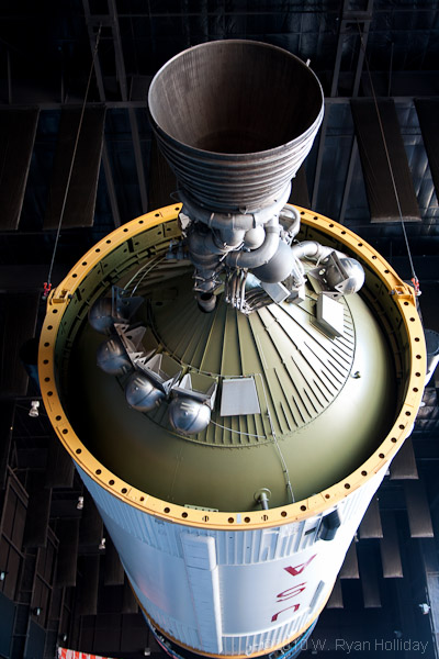
Anything on the map that in any way relates to spaceships tends to be difficult for me to avoid, and thus it was that today’s destination was the Marshall Space Flight Center in Huntsville, Alabama. After a cold (temperature: 19°F) pre-dawn wakeup followed by another thirty or so miles of the Natchez Trace Parkway, the Subaru and I set off across Northern Alabama in search of rockets. At about ten o’clock the top of a Saturn V became visible on the horizon, and from that point onwards my mood was of the sort that usually leads Audrey to disavow that she actually knows me.
The space center is home to a museum that features a Saturn V rocket that was never sent into space. It’s the largest and most powerful space vehicle ever produced by man, with each of the five first-stage engines measuring twelve feet in diameter, and a total rocket height of over 36 stories; I was giddy. In addition to the Saturn V, the actual Apollo 16 command module, tons of mockups from other missions, and a “Rocket Garden” with everything from full-scale models to test vehicles were all on display. Since it was a Monday in December the staff seemed to outnumber visitors, so there was plenty of space to take it all in. While I generally try to keep him at bay, today the inner geek ran wild and free.
I met an old friend from the long-ago Andersen Consulting days for lunch today and partook of barbecued oysters and a shrimp & oyster po’boy – New Orleans continued to impress with its food. Cregan was brave enough to bring his wife along, and hopefully I didn’t frighten her too badly. His life since last we spoke included buying a house in New Orleans thirty-one days before Katrina – apparently insurance kicks in on day thirty, so he is insanely lucky if such a thing can be said of someone whose house ended up under five feet of water.
The day’s other activities included more roaming the streets of New Orleans, more wildlife refuge visits, and, after two horrid and uncomfortable nights of beds and showers, a joyous return to sleeping in the back of the car. The plan for tomorrow is to invade Mississippi, although thus far on this trip I’ve gotten distracted by everything from bridges to birds to trees to massive radio telescopes, so no plan is in any way certain.
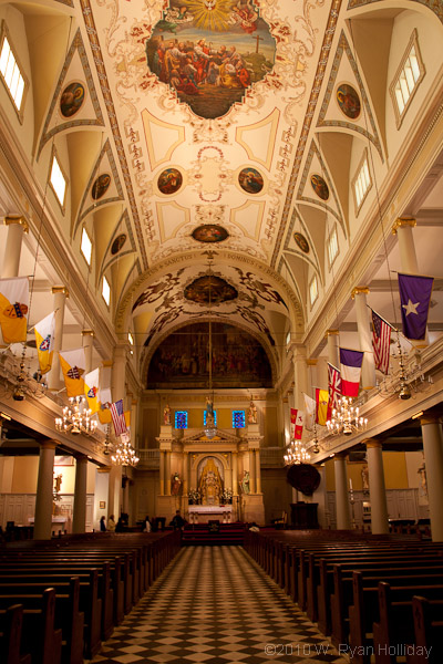
The universe intervened on the roadtrip last night, and after driving for an hour without finding anywhere suitable to spend the night White Sands was removed from the itinerary; I probably should have known that overnight parking areas would be limited near a national monument surrounded by a government missile testing range, but I’m not often accused of having an overabundance of brain matter.
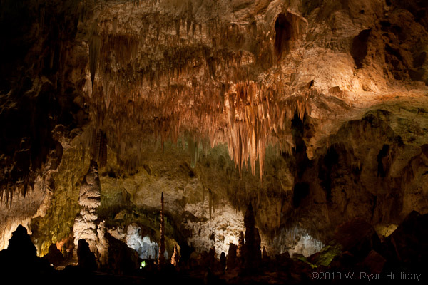
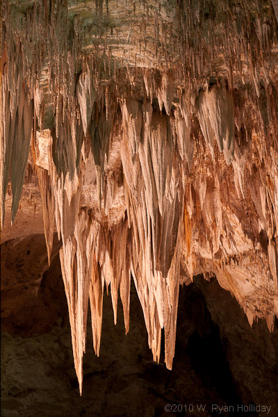
Missing White Sands probably worked out for the best as Carlsbad was further away than I realized, and despite waking up before 7AM, arrival time at the park wasn’t until after 10AM. From there the fun began: Ryan loves him some caves. Photos of Carlsbad can’t do it justice – the cave formations are probably more amazing than any other easily-accessible cave in the world, but the most awe-inspiring thing (to me) is how big it is. There are multiple rooms with ceilings well over a hundred feet high, and the aptly-named “Big Room” is 4000 feet long and 625 feet wide at its widest point; it’s tough to imagine how something like this could be engineered by man, much less occur naturally.
After four hours of romping through the cave it was time to leave, and I’m now making a beeline for Louisiana, although a large state that smells strongly of oil lies in-between. I haven’t quite figured out what the route across Texas will be, but it’s likely to take most of the day tomorrow, after which this roadtrip will be in uncharted territories and hopefully involve much more exploring and much less driving.
The town of Winslow was along the route last night so I decided to be a tourist, stopped, and yes, stood on a corner. I didn’t see a girl in a flat-bed Ford (my Lord) but there was a guy in a F150, so mission accomplished.
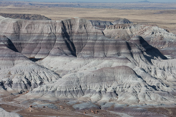
Today I woke up just before sunrise to a temperature of 38°F, drove to the gates of Petrified Forest National Park, and, while the horizon turned amazing shades of purple, stared in horror at a sign indicating the park didn’t open for another hour. That disappointment aside, the four-hour park visit was a good one – there were far too many photos and far too little hiking, but the supposed goal of this trip is to visit the Southeast so some sacrifices are needed.
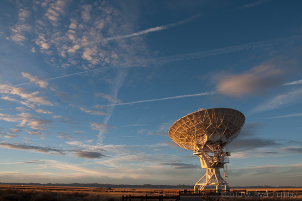
What little plan there is for this roadtrip calls for getting to new places as quickly as possible and limiting the number of visits to old haunts, but White Sands and Carlsbad Caverns are kind of on the way, so I pointed the Subaru in that direction. I’m doing my best to travel backroad highways as long as there is daylight, so I was debating the merits of three possible routes when a dot on the map caught my attention: National Radio Astronomy Observatory. From that point the route was clear, and the fifth of December 2010 will live forever as the day Ryan went to the Very Large Array. The geek juices were flowing strong as I came upon 27 radio antennas, each 25 meters in diameter, spread across 22.3 miles of a high mountain plain. Sadly I only arrived with an hour to spare before sunset, but made the most of it by hurriedly visiting each part of the facility that didn’t have an “authorized personnel only” sign. Am I a huge dork? Clearly. But I am a very happy dork.
No journal update yesterday – I mostly lounged, and an attempt to photograph birds failed miserably when the wildlife refuge gates were locked at 4:30 PM.
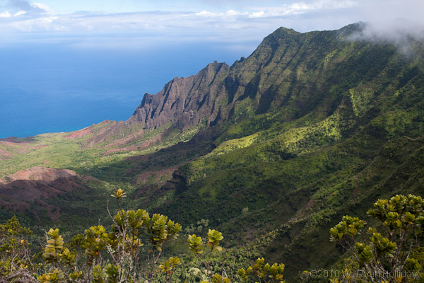
Today was my last day on Kauai, so I decided to get dirty. After waking up at 5AM I left the disappointingly unimpressive Kauai Beach Resort and headed back towards Waimea Canyon for some more hiking. The handful of photos I took along the way turned out rather bland, but hopes were higher for a hike at the end of the road at 5000 feet elevation above the Na Pali coast. The trail started out slick and got about an order of magnitude sloppier with each quarter mile, and the last bit was a slog through a river of mud all the while pulling myself up rocks with whatever vegetation was available – six year old Tevas with worn off treads were clearly the footwear of champions today. The views along the way were great, and the challenge of trying to hike without getting completely disgusting was a fun one.
Following the jungle-slog-of-filth-and-domination I headed to the far end of the island to a beach that the guy at Subway said was his favorite. I was momentarily stopped by a “four wheel drive only” sign, but Hawaii is clearly not as hardcore as Utah and the rental Dodge made it to the beach without any trouble. Kauai is an island with narrow sand beaches and a lot of rock, but this beach was an exception with its massive expanse of sand set against the cliffs of the Na Pali coast – Subway guy is all good with his recommendations.
The red-eye for home leaves in a few hours, but luckily the weekend has a few days remaining before the slog back to work starts again. Vacations are definitely good things.
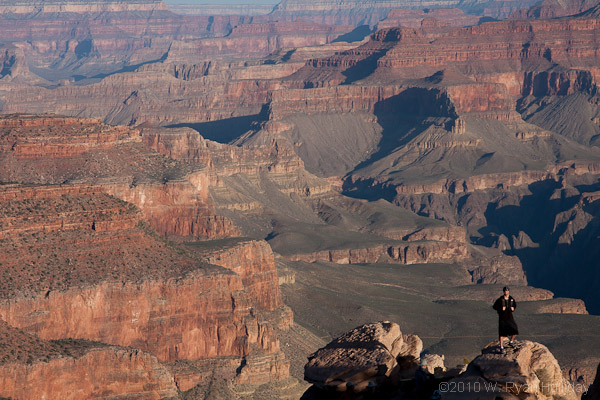
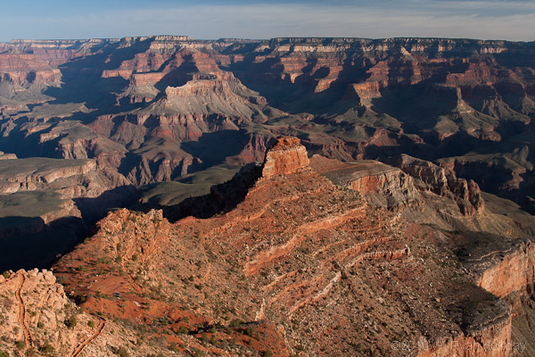
Two weekends ago Aaron and I met in Phoenix to hike the Grand Canyon. After making the acquaintance of the poop-eating dog and watching a stranger blow up Aaron’s ego by telling her friend “Look, it’s Chris Daughtry” we headed north to the park. My all-time record for rim-to-river-and-back hikes stood at something like 4-2 when we started (hiking in the heat is not my strong point), but we set off on the 16-mile round-trip with tons of Gatorade and confidence brimming.
Before continuing the story, for anyone visiting the Grand Canyon don’t try to hike down and back in a single day. The park warns against doing this hike for a reason, but Aaron and I are both in pretty good physical condition, and more relevant, we’re both stupid people.
The route we chose took us down the Kaibob Trail to the Colorado River and then along the river before we started back up the Bright Angel trail. This is where things got interesting. Nature decided that ascending five thousand vertical feet wasn’t enough of a challenge, so she threw temperatures at us that were twenty degrees above normal. Hiking through the desert, uphill, when it’s 105 degrees in the sun isn’t an ideal scenario for someone who likes to vacation in Alaska and the Antarctic. Aaron and I were both suffering by the time we got back to the top, but sadly I was the one in worse shape. Despite having to stop frequently to rest my spasming quads this one will go into the books as a draw, which puts the current all-time record at 4-2-1. Next time, however, we’ll go in March when it’s guaranteed to be cooler, hike it twice, and put two more ticks in the win column.
Today was the earliest day of the trip thus far with a 5:30 wakeup – Audrey was surprisingly mentally alert, although she had scouted the entire town the night before to make sure she could find coffee (for anyone in a similar predicament: there is a pot they keep brewing at the desk of the Mammoth Hotel). After the drive out to the Lemar Valley we joined Russ (the ham radio operator), Rick (the wolf biologist) and a small crowd on a hillside and got to watch three wolves, some bison, a few elk, a pronghorn and a handful of bighorn sheep through the myriad spotting scopes that people had with them.
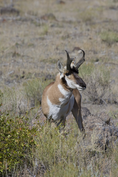
After breakfast the temperature had risen from 25°F to a balmy 35°F so we headed up to the huge, terraced springs that give the area its name. Following that excursion and a short nap Audrey wanted to add Montana to the list of states she’s visited, so we made the quick trip up to Gardiner, stopping along the way to photograph a pronghorn that was standing in a turnout – having recently told Audrey that I thought the pronghorn is the one animal that is so wary that it would never, EVER let anyone get closer than about fifty yards, this fellow spent five minutes posing for pictures thirty feet away from us.
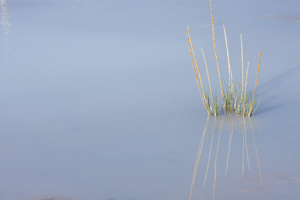
We ended the day with a drive up to the Norris Geyser basin which is the home of Steamboat Geyser, the world’s largest geyser, capable of erupting to over 300 feet in height. Its eruption cycle is from four days to fifty years, and with the last eruption having occurred in May 2005 we decided not to wait around to see if it was our lucky day. While the geysers were neat, the highlight was actually the scenery along the drive, including a stop on the outbound and return trip to re-visit with some of the wolf folks who were on the lookout for the Blacktail pack which had killed a bison in the area; we missed the wolves but saw (and heard) a coyote and a good number of elk, and Audrey was given a really cool photo by a really nice professional photographer who was hanging out in the area, so all was well.
