Ryan's Journal

"My life amounts to no more than one drop in a limitless ocean. Yet what is any ocean, but a multitude of drops?" — David Mitchell

A Day of Old Trees

Posted at 8:30 pm, October 9th, 2020

This journal entry was written in October but not published until January.

The theme of visiting new places continued today; I started out with 2000 year old sequoias in the Tuolumne Grove, one of Yosemite’s three sequoia groves and the only one that I’d never been to before. After spending a couple of hours among the ancient giants I enjoyed another scenic drive along Tioga Road and through the High Sierras before heading south towards home on Highway 395.

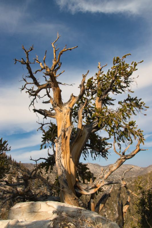
I’ve mostly only been able to visit the Eastern Sierra in winter or spring when snow closes the high passes, so this autumn trip finally afforded an opportunity to make the side trip up to the White Mountains and the Ancient Bristlecone Pine Forest. Located at 10,000 feet elevation, this area is home to the world’s oldest trees – at more than 4,000 years of age, these tiny, gnarled trees made the 2,000 year old sequoias look like babies. The road to reach them was a classic western road – narrow, bendy, and traversing impossible terrain with awe-inspiring views of incredible scenery in all directions. After arriving at the Schulman Grove, a 4.5 mile trail led through the old trees and onto ridges with dramatic views of the Sierras and Death Valley. Spending an afternoon free of other people among trees that were around while the Egyptians built the pyramids was an excellent way to escape from the world’s current troubles.

Ancient Bristlecone Pine
This tree has likely seen at least one hundred generations of humans during its lifetime.

Yosemite in the Time of COVID

Posted from Yosemite Valley, Yosemite National Park, California at 7:05 pm, October 8th, 2020

This journal entry was written in October but not published until January.

I’ve currently got two weeks of vacation, and it is glorious. Due to coronavirus I didn’t plan anything in particular beyond a visit to see my parents in the Bay Area and a couple of days with my brother at his place up in Truckee. After hiking around Tahoe I said goodbye to younger Holliday yesterday and took random backroads down to a very smoky Yosemite National Park – apparently smoke from all of the fires from the rest of the state is filling the air here. That said, the air doesn’t feel dangerous, so I got in a hike in Tuolumne Meadows yesterday before setting off on a more ambitious journey today. Sadly my number didn’t get picked in the lottery for Half Dome permits, so instead of a death march up one of the world’s greatest (and most tiring) trails I traveled up the first half of the trail before detouring onto a path I’d never taken before towards Glacier Point. Being outside again feels good, the trails were reasonably empty, and I may or may not have spent portions of the hike talking to the squirrels, jays, woodpeckers, junkos, and quail who I met along the way. Sadly, while my workout routine seems to have been sufficient to prepare me for the uphill portions of this journey, whatever muscles are involved in going downhill have atrophied to the point of uselessness, and after a two hour descent of several thousand vertical feet I’m not sure I was able to fully stifle the scream of relief when I finally collapsed into my driver seat at the end of the day. It was a good day, and there’s more to follow tomorrow.

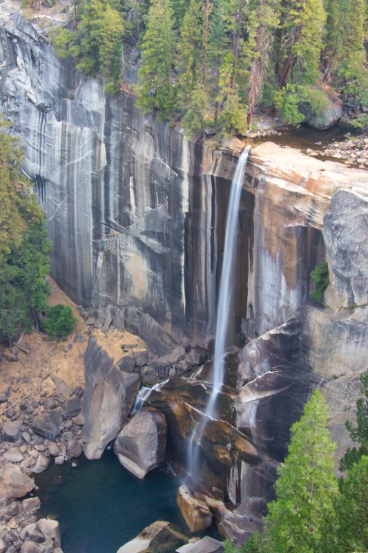
Vernal Falls
Vernal Fall in Yosemite. They turn off the water in autumn, spring photos are generally much more dramatic.

Profoundly Strange

Posted from Culver City, California at 6:30 pm, December 30th, 2019

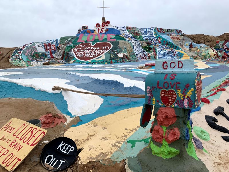
The 2019 Man Trip concluded today after visiting some places I’ve wanted to see for a while. The day started with a trip to the Salton Sea, a place whose weirdness I described after my first visit in 2005. After roaming through empty lots in Salton City I made my way to Salvation Mountain and Slab City. Salvation Mountain is an artwork/ode to God that covers an entire hillside. It was made from clay and thousands of gallons of paint, and its creation took decades for a single man to complete. In an address to Congress regarding Salvation Mountain, Senator Barbara Boxer described it as “profoundly strange”, which is as good of a summary as any.

As odd as Salvation Mountain was, it paled in comparison to the nearby “town” of Slab City. I had first learned of this location from the book Into the Wild and have wanted to see it ever since. My best description is that it’s a bit like what you would expect if Burning Man was a town populated by people without any money. Every winter RVs converge on this spot in the desert, and folks settle in for the season, bringing a commune-like existence that is combined with equal measures of art, libertarianism, and plain old crazy. I spent ten minutes talking to one resident about conspiracy theories he’d heard on the internet, drove by an RV that was decorated in doll heads, and passed numerous spots that showed inspiration that might have put Andy Warhol to shame. All in all I left certain that this was the strangest place I’ve ever visited, and I’d actually like to go back again some day; my new conspiracy-sharing friend might have inspired a future visit when he noted: “there’s music every Saturday night, although if you come in the summer there are only three singers who perform the same five songs.”

From Slab City it was a roundabout route home, passing through Anza Borrego desert, into the mountains, through Temecula, and back to my home with a short detour to SpaceX headquarters to see the rocket, since it was on the way and rockets are awesome. Now I’ve got a couple of days of showers and warm beds to allow me to fully decompress before returning to work again.

Salvation Mountain
Often with art it can be difficult to determine what the artist’s message is supposed to be; it is fair to say that the message behind Salvation Mountain is not hard to decipher.

Shower Time

Posted from Indio, California at 6:30 pm, December 29th, 2019

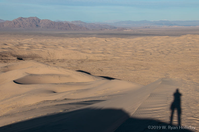
I woke up just before sunrise a few miles from the Kelso Dunes, and started the day with a hike up the dunes to take in the Mojave National Preserve from above; not a terrible way to start a day.

Continuing this trip’s theme of visiting new places, I headed south from Mojave to Route 66 and the town of Amboy (population: 4), which is apparently located next to a massive volcanic cone, a huge lava field, and a giant dry lakebed that is now a chloride mine. Who knew that combination existed? Heading south from there I eventually got to Joshua Tree National Park, which is apparently WAY more popular than it was when I last visited a decade ago. Watching people park on the roads, walk off trail, and generally disregard all park rules I was reminded how much the other humans stress me out, so I found a mostly-empty lot next to a trailhead and hiked up Porcupine Wash until the only reminder that other people inhabit this planet was the sound of planes overhead.

Tonight I was actually debating heading home to take a shower, but decided that was nuts since I so rarely get time to take a road trip, so I sprung for a hotel room, washed several layers of stink and pain off in the shower, and will sleep in a warm, comfortable bed for the first time in a few days before getting up early to conclude this little adventure tomorrow.

Self-portrait, Kelso Dunes, Mojave National Preserve
Self-portrait, Kelso Dunes, Mojave National Preserve. Starting the day alone on a dune several hundred feet above the desert floor is not a bad way to live.
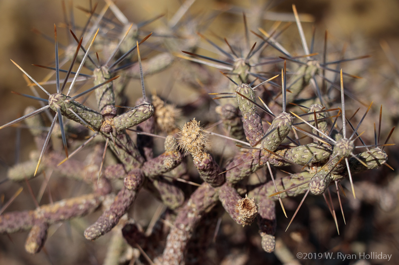
Cactus Detail, Mojave National Preserve
Cactus Detail, Mojave National Preserve.

Driving Through Rivers

Posted from Kelso Dunes, Mojave National Preserve at 8:15 pm, December 28th, 2019

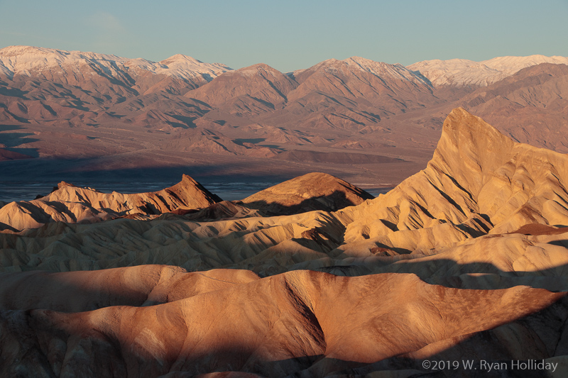
Day two of the man-trip. I got up just before sunrise and headed up to Zabriskie Point to enjoy the start of the day, then took the 4.5 mile Gower Gulch trail through Golden Canyon to enjoy some alone time on a trail that I’ve never hiked before. From there I took the West Side Road south towards the park exit, a rough dirt route that travels 36 miles around the Badwater Salt Flats and provides a less-traveled alternative to the main park road. I had been warned by a ranger that the road might be in poor shape following recent storms, but after an hour and a half I’d made it almost back to the main highway without encountering any issues, only to discover the normally-underground Amagorosa River flowing across the road. The water only looked like it was about six inches deep, so I rolled the dice that I wouldn’t get stuck in mud and roared through it, luckily emerging unscathed at the other side.

My original plan for this trip had been to roam around the northern part of the park, but since storms apparently made a mess of the backcountry roads I instead decided to leave the park and head south, ending up in Mojave National Preserve for the night. The Milky Way is shining overhead, but surprisingly the lights of LA (150 miles west) are hiding stars on the western horizon, while the lights of Las Vegas (100 miles east) fill the opposite horizon.

Zabriskie Point at Sunrise, Death Valley National Park
Zabriskie Point at Sunrise, Death Valley National Park.

Airplanes, Sheep & T-Shirts

Posted from Furnace Creek, Death Valley National Park at 7:00 pm, December 27th, 2019

After missing out on my annual post-Christmas road trip last year, I managed to procure a week off to embark on what Audrey calls the “man trip”. These trips are always spontaneous, and since Aaron and I wanted to get lunch together the day after Christmas, this year’s trip started in Sacramento and continued to just outside of Reno before day one came to a close. Today was day two, and things really got going:

  • I woke up at about 6:30 and made my way over to Tesla’s Gigafactory where I got a view of what will eventually be the world’s largest building.
  • From there I headed southeast and saw what I assume were wild horses up on a ridge. I have no idea how to distinguish wild horses from domestic horses, but if this was a domestic herd then they were roaming unfenced grasslands miles away from the nearest ranch.
  • A dot on the map had caught my eye when I set out – “Naval Air Station Fallon” – and after detouring to see what was there I got to watch fighter planes take off and land from just beyond the end of the runway. Since it makes perfect sense that a naval air station would be located next to 5,000 year old petroglyphs I also got to see prehistoric rock art in between fighter launches.
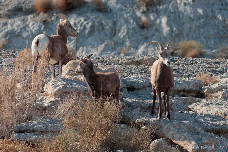
  • Continuing south along rural Nevada 95, I hit Walker Lake, the remnants of 8,500 square mile prehistoric Lake Lahontan. It was at this point that a herd of desert bighorn sheep showed up near the road, so the next hour was spent making their acquaintance.
  • Just south of the lake was the massive Hawthorne Army Depot – apparently the world’s largest ammo depot. There were literally miles of bunkers across the valley floor.
  • By this point it was only noon. It was inevitable that the day would slow a bit, and most of the remainder was spent meandering south through old mining towns that littered the wide open expanses of Nevada. I passed a herd of what I assume were wild burros at one point, and arrived near sunset at Death Valley.
  • After arriving at the Furnace Creek Visitor Center to buy a new park pass I saw a kid standing outside with a shirt that read “I paused my video game to be here”; it’s unclear if he was just a cool kid or if he has parents with an awesome sense of humor.
  • Sadly a storm came through Death Valley yesterday and made many of the more interesting roads impassable, so instead of spending the night alone up on a ridge under the stars, I’m in a campground sharing this incredible view of the Milky Way with a hundred other folks who I can only hope will recognize that quiet hours start at 9.
Desert Bighorn near Walker Lake, Nevada
As always seems to happen with bighorn, I was looking at every tiny detail in the high cliffs on the west side of the road when a herd popped up ten feet from the eastern side of the highway.

Man Tripping No More

Posted from Culver City, California at 9:46 pm, December 30th, 2016

The 2016 Man Trip finished up yesterday with a morning visit to the Carrizo Plain National Monument, a virtually unknown national monument west of Bakersfield. The park is home to Soda Lake, which is supposedly an internationally-known area for birds, but the last time I visited it was completely dry. This time I left Bakersfield and spent an hour and a half meandering through the hills, oil fields and solar farms of Kern County before arriving at Soda Lake, which despite several recent storms was still bone dry; I think I heard the universe laughing at me.

Despite the dry lake it was still nice to be reminded how nice silence is – the modern world is constantly filled with the sound of cars or appliances or planes, but you don’t realize it until you’re in a place that is just completely still, and I sat at the end of a boardwalk for about an hour just enjoying the peace. Afterwards I wandered a bit more before pointing the car towards home, where I’ll hopefully get some rest and recharge before starting off the 2017 work year.

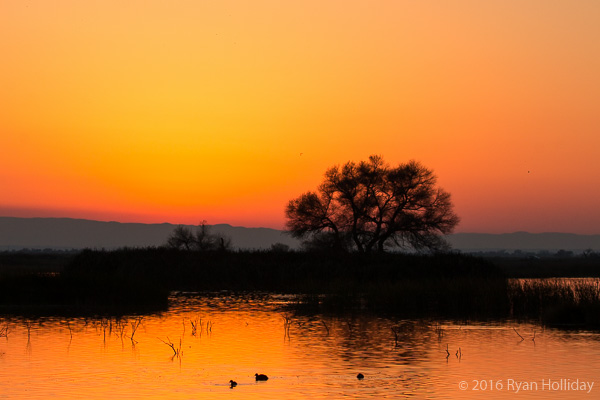
Sunset at the Kern NWR

Taken during sunset at the Kern NWR.

Man Tripping

Posted from Bakersfield, California at 8:39 pm, December 28th, 2016

I’m pretty sure that the entire San Joaquin Valley reeks of cow manure. Someone really needs to look into it, because it can’t be benefiting tourism to have things smelling poopy.

Woke up at 5:30 this morning, an hour before my alarm, since the universe likes it when you see the sun come up. Merced National Wildlife Refuge was the sunrise destination, and Kern National Wildlife Refuge was the sunset destination, and both were chock full of birds and people shooting at birds (duck stamps help pay for wildlife refuges). Wedged in between those two visits was a giant biscuit at the Black Bear Diner, because it wouldn’t be a man trip without a manly breakfast.

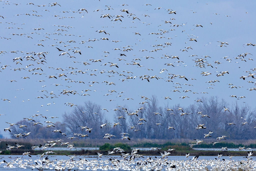
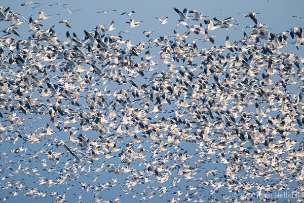
Snow geese in Merced NWR

I zoomed in on the full resolution image, and so far as I can tell not a single one of these snow geese is bumping into his neighbor. Taken in Merced NWR.

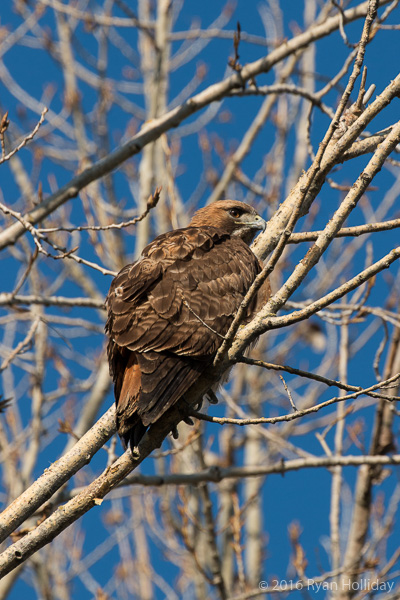
Red-tailed hawk in Merced NWR

Red-tailed hawk in Merced NWR.

Man Trip, 2016

Posted from Merced, California at 8:47 pm, December 27th, 2016

Like most years, I started this year’s post-Christmas man trip with no real destination in mind. Since we don’t get much time together anymore it seemed like a good idea to spend the start of the trip with my brother, and on the way to his place I stopped to see the birds at the Cosumnes River Preserve. Upon arriving I discovered that all of my camera batteries were dead; the cranes flying low overhead had a mocking tone to their calls.

This morning after departing Sacramento I pointed the car towards the mountains and did some exploring in Gold County, one of the only parts of California I haven’t really wandered around in. The route began with a visit to Placerville, which is home to the oldest continually-operated hardware store west of the Mississippi; it’s actually cooler than it sounds, and I spent a while admiring the old-timey bins and beams and such. From there I meandered down to Murphys, taking in the rolling hills and small town scenery along the way. After a lunch in the historic Murphys Hotel I almost booked a room so I could spend a night in a building built in the 1850s, but instead decided to get a nature fix and headed up to Big Trees State Park to see sequoias in the snow, since snow obviously makes giant trees even better. While continuing along Highway 49 I passed a bizarre group of buildings, and sensing that the universe wanted me to stop I spent a short time exploring Columbia State Historic Park, which has a super-weird Williamsburg-wannabe-in-the-middle-of-nowhere vibe. I left the place almost as confused about it as when I arrived, but later learned that the state bought the town in the 1940s and now runs it as a living museum. From there it was on to Merced, where I’ll be making the seemingly annual pilgrimage to see the birds at the Merced National Wildlife Refuge tomorrow morning at sunrise.

The Day of Five Caves

Posted from Shasta National Forest, California at 8:17 pm, May 10th, 2015

Lava Beds National Monument is a pretty cool spot. By 1PM I’d explored five of the park’s caves, all of them very different. Golden Dome Cave had me on my belly at one point pushing between rocks, Sentinel Cave was an easy 1000 meter underground stroll, Skull Cave was a short yet ENORMOUS cavern, with a lava tube passage large enough to fit an airplane. Valentine Cave and Sunshine Cave offered a bit of everything, with some scrambling and some easy bits. I lucked out and had every cave almost completely to myself – being in absolute darkness with only the sounds of dripping water is a stupendous environment for sitting and thinking.

Following the below-ground explorations I did a bit of above-ground exploration, then returned to the Tule Lake Wildlife Refuge before moving on. Now I’m parked in the forest under Mount Shasta as thunderstorms intermittently pass by. So far this has been a much-needed break from life in the city.

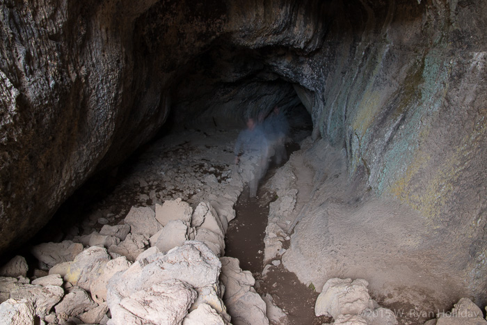
Sunshine Cave in Lava Beds National Monument

Sunshine Cave in Lava Beds National Monument.

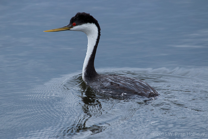
Western Grebe in Tule Lake National Wildlife Refuge

Western Grebe in Tule Lake National Wildlife Refuge.

All the Caves

Posted from Lava Beds National Monument, California at 8:59 pm, May 9th, 2015

I only saw one other car this morning as I was roaming around the antelope refuge, and that sort of set the tone for the day – for the most part, today was a day of little-used roads, the sort where if you see another vehicle then the drivers wave at one another. After roaming the dusty dirt roads of the antelope refuge I headed back towards California via some apparently little-used state roads. Once back in the state where pumping your own gas is legal I headed towards Goose Lake, which is a spot on the map that has always intrigued me. It’s as big as Tahoe on the map, but you never hear about it. And when I arrived, I found out why – it’s not there; a dry lakebed and plumes of dust filled the spot where a ginormous lake was supposed to be. A missing lake seems like reason #5,346 why the world needs to figure out the whole fresh water supply thing.

After the non-lake I made a brief trip through the Modoc National Wildlife Refuge, then it was on to the surprisingly awesome Lava Beds National Monument, and the neighboring Tule Lake Wildlife Refuge. I won’t do a species list since that would be boring, but the summary report is that the snake I saw today most likely was of the poisonous variety, and apparently California is home to pheasants, something I never realized despite living here for 17 years. The other attraction of this park is that it is lousy with caves, and with one half-mile long lava tube explored today, the plan for tomorrow is to see what some of the others are like.

Also, since it’s a neat thing, as I started writing this entry I could see the silhouettes of two deer next to my car, licking ash from the campground firepit; sharing a campsite with deer is not an experience I tend to have while working.

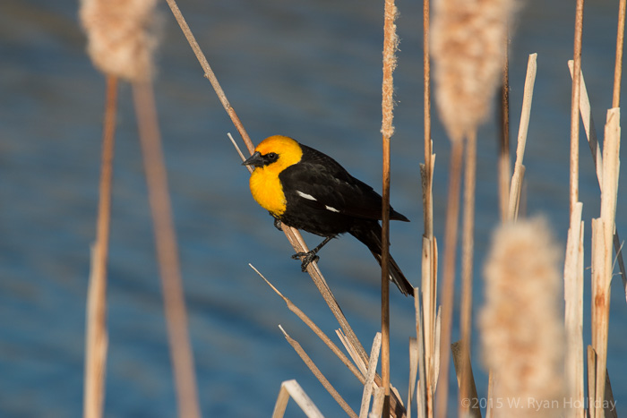
Yellow-headed blackbird in the Tule Wildlife Refuge

From the same people who brought you the ever-so-creatively-named “red-winged blackbird”, this is the “yellow-headed blackbird”.

Where the Deer and the Antelope Play

Posted from Hart Mountain National Antelope Refuge, Oregon at 7:52 pm, May 8th, 2015

I’ve got a couple of weeks between projects, so I put the Subaru in drive mode and went up to San Francisco to take the folks out for a nice meal, visit with Audrey, and then I took off with no particular destination in mind.

Day one took me through Feather Canyon, which is the lowest elevation pass through the Sierras, and a place I’d never visited before. A bald eagle flew by to say hello, which was nice, and a deer burst out of the bushes next to the road and tapped my front bumper, which was less nice, although she bounced back up and ran into the woods so hopefully all was well. From there I passed through Lassen Volcanic National Park, although even in the midst of a drought almost everything but the main road was still closed by snow. On a less nature-y stop I went to Starbucks in the evening and was entertained by a stoner who kept standing up in his seat every few minutes to yell out “I feel His power, man! Glory to Him!” The night was spent sleeping soundly in the back of the Subaru in a national forest campground near Lake Shasta.

The behemoth volcano Mount Shasta towered 14,162 feet overhead the next morning, and an equally large biscuit greeted me at the original Black Bear Diner, which I stumbled on while meandering through the area. Post-breakfast I was in Oregon, a state known for its fear of allowing people without proper training to pump their own gasoline. I made it up to Oregon Caves National Monument, but decided against descending into a subterranean cavern for 90 minutes when a carload of six screaming kids pulled into the parking lot behind me, each of them making their best effort to ensure that I fully appreciated how peaceful it had been prior to their arrival. After a nice hike through the forest I took the next available tour, this one mercifully with just two very well-behaved kids on it, and spent the next hour-and-a-half scrambling around underground on the rocks. After another aboveground hike I was leaving the park when one of the park’s employees flagged me down, and I ended up giving a short ride to a girl who offered to let me know what plans the universe had for me according to her astrology book. I politely declined, dropped her off at the employee housing, and spent the night camped next to a stream down some random logging road.

Today I stopped in Klamath Falls where another bald eagle was hanging out, and then made my way east to the Hart Mountain National Antelope Refuge – I saw it on the map and figured anything in the middle of nowhere and full of antelope must be worth a visit. I did some hiking, hung out with deer, pronghorn, sandhill cranes, hawks, vultures, snakes, and myriad other critters, and now I’m parked for the evening in a quiet corner of the refuge with no one around and a herd of deer staring at me from a hundred yards away as I type, they munch, and the sun sets. It’s a far cry from sitting in my kitchen working in front of a computer, and a much-needed chance to make sure life is going the way it should be and figure out what course corrections that might be needed.
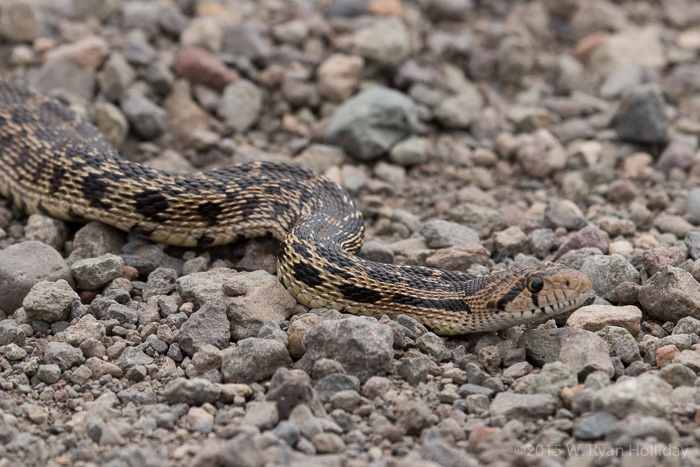
Gopher snake in Hart Mountain National Antelope Refuge

The logical voice in my brain said “I’m 99% sure that this is not a poisonous snake and I should move him off the road so that he doesn’t get hit”. Hopefully the snake eventually got out of the road on its own, ’cause that 1% worth of doubt won the argument.
Man Trip Postscript

Posted from Culver City, California at 1:03 pm, December 31st, 2013

After getting home Sunday night I woke up Monday morning at 6:30 and headed down to the Marina to see what was stirring. Turns out that the place is lousy with grebes, which have apparently converged here in huge numbers for the winter.

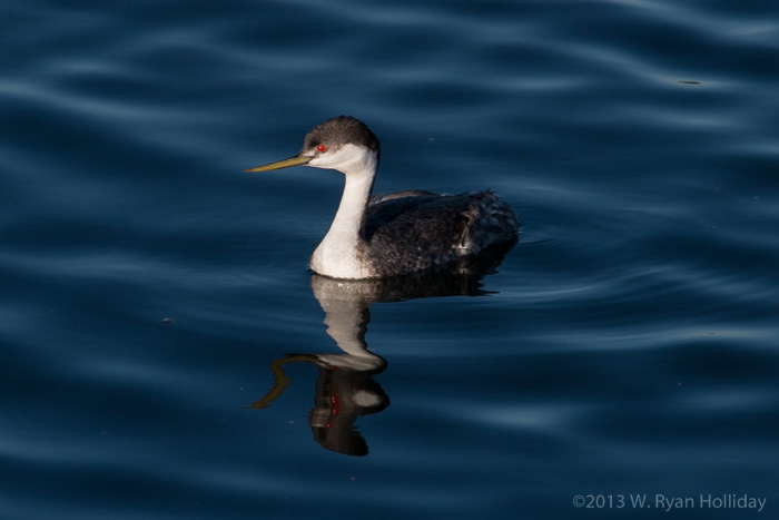
Western grebe in Marina del Rey

Western grebe in Marina del Rey. As I told Audrey, the bird’s red eye is really pretty and also a clear indication of demonic possession.

Where the Streets Have No Name

Posted from Ojai, California at 6:53 pm, December 29th, 2013

Today ended up as a meandering journey through the hills and mountains of Southern California. Wake-up preceded the sunrise in the Carrizo Plain, and I wandered about in the early light enjoying the quiet. Following a short hike along the San Andreas Fault the path led in a roundabout way to the Tule Elk State Reserve, which was home to the last of the species when it was formed in 1932, and which has been the source of nearly all of the 4000 tule elk that today roam numerous locations throughout California. From there it was off to the Bitter Creek National Wildlife Refuge, which is where much of the protection efforts for the California Condor have been focused. Sadly access to the refuge is closed to the public, and since no birds were visible from the highway I settled for enjoying the mountain scenery and the many hawks that managed to outsmart my photographic attempts.

From there all paths seemed to require crossing Los Angeles County, so despite the inner voice telling me to deal with the traffic and highways of LA and then visit the Salton Sea, I decided to make this year’s trip shorter than in years past and explored the backroads of the Los Padres National Forest while heading in a generally-homeward direction – we’ve got some surprisingly cool mountains within a two hour drive of the Culver City abode. Tonight’s sleeping place will either be back in my own bed, or in the back of the Subaru if an interesting option presents itself along the way.

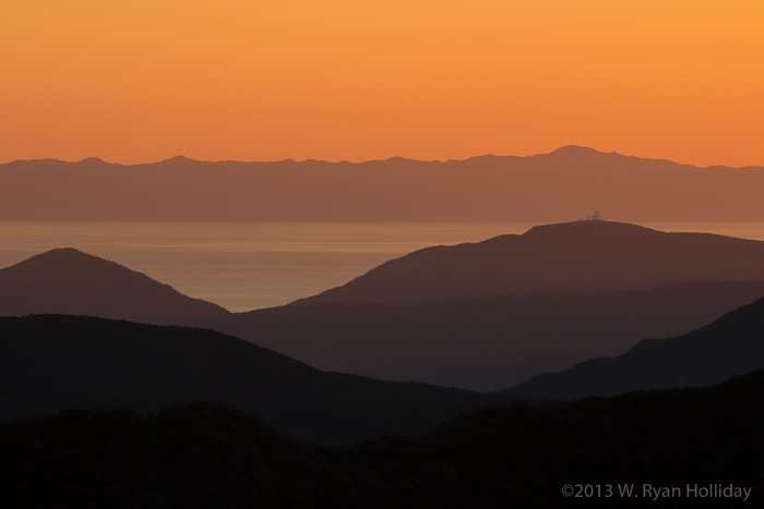
Sunset over the Santa Barbara Channel

Sunset over the Santa Barbara Channel. Were I better with Photoshop and less conscientious about altering photos the towers on the mountain would not be in this photo any longer.

Next Services: 82 miles

Posted from Carrizo Plain National Monument at 6:37 pm, December 28th, 2013

It’s quiet here. Utterly still. I stood on a hillside this morning and could hear the footsteps of people walking on a trail more than a half mile away, and that was one of the few times that I was around other people. I probably needed to get away to a place like this one.

The Carrizo Plain protects one of the last undeveloped stretches of California grassland, a famous set of petroglyphs, the largest concentration of endangered plants and animals in California, and a stretch of the San Andreas fault that shifted nearly thirty feet during an earthquake in the 1800s. To my eyes the area looks like it needs time to recover from centuries of heavy grazing, but with the relatively recent designation as a national monument hopefully it will get there. As a travel destination it is suffering from the third straight dry year – Soda Lake, known as a good winter wetland spot, is a dry salt flat – but it’s still a great location for getting away from everyone. It seems bizarre to be only about one hundred miles from Los Angeles, but to feel like this is the absolute middle of nowhere. The roads here are almost all unpaved old ranch roads, so I spent the day roaming about before parking for the night in a corner of the park with a view of the plain and absolute silence, aside from the occasional bird flying by. This journal entry is being written from the back of the Subaru with stars blazing, the cell phone showing “No service”, and the nearest town an hour’s drive away.