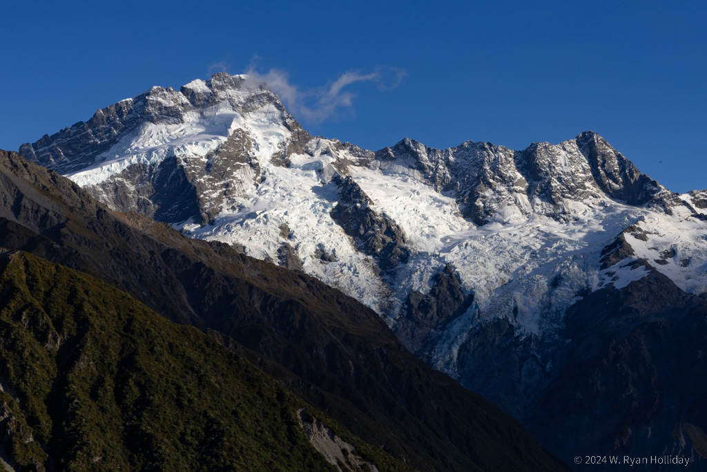
Ryan's Journal

"My life amounts to no more than one drop in a limitless ocean. Yet what is any ocean, but a multitude of drops?" — David Mitchell

Tree Ferns

Posted from Lake Moeraki, New Zealand at 11:28 am, April 1st, 2024

I spent the day roaming around a 200 million year old rainforest and then kayaked all afternoon before feeding some longfin eels, because somehow that’s my life at the moment.

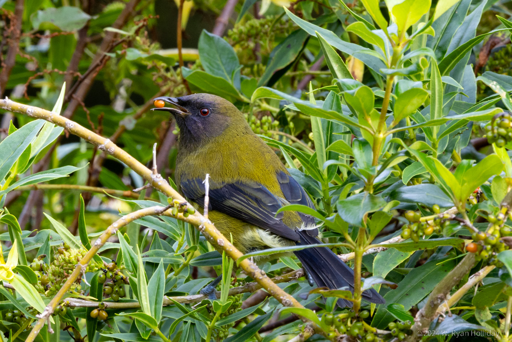
The rainforest continues to fascinate. I’ve seen rainforest elsewhere, but it always seemed like a normal forest that was much lusher and more overgrown. Here, it’s primordial. Twenty foot tall tree ferns tower over you, while lichens that are a foot across hang from the massive limbs of 1000 year old trees. Ferns and orchids grow on every exposed surface of every trunk and branch. I was humming the Jurassic Park theme while hiking today, and it seemed as if a herd of small dinosaurs might be around the next corner everywhere I went.

After a morning spent hiking in the forest, I hopped into one of the lodge’s kayaks for the afternoon. A short paddle up the river to the lake put me in view of the waterfowl, and in a country with few natural predators they all apparently decided that I was the scariest thing on the planet and fled whenever I got within fifty meters. It was nonetheless a relaxing way to spend two hours, silently gliding through the water with rainforest all around.

Tomorrow it’s north to the town of Franz Josef for a stop to see some of glaciers that flow west over the mountains, then it will take another day to get up to the next pass back east over the mountains and on towards Abel Tasman National Park on the South Island’s north coast.

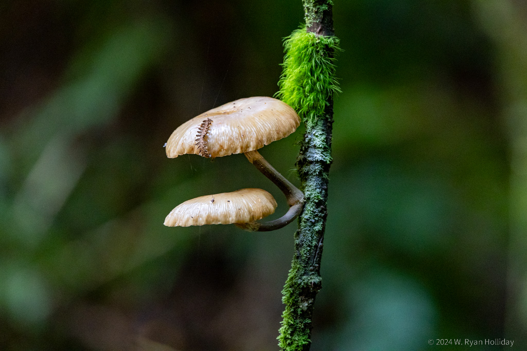
Rainforest Detail near Lake Moeraki

Mushrooms and moss growing on a vine in the rainforest.

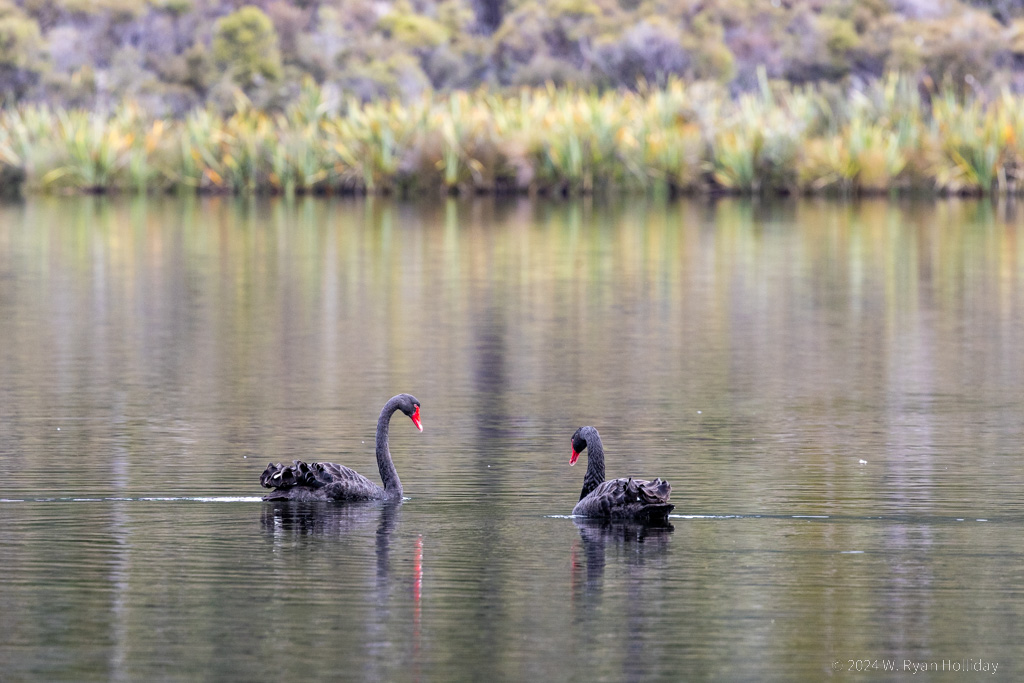
Black Swans, Lake Moeraki

Black swans in Lake Moeraki.

Godwanaland

Posted from Lake Moeraki, New Zealand at 11:05 am, March 31st, 2024

The West Coast of New Zealand’s South Island is remote. The informational signs at pullouts keep referencing how much of the plant life here is unchanged since it evolved 200 million years ago when all of the continents were mashed together into a mass we call Godwanaland today, and as you wander around under dense rainforest filled with fifteen foot tall tree ferns and thousand year old moss-covered trees it’s easy to imagine dinosaurs roaming the forest. Meanwhile the Tasman Sea stretches off endlessly to the west, while the Southern Alps rise vertically in the east, and signs of civilization are few and far between. So far, I’m liking it.

The lodging for the night was one of my two splurges on the South Island. It’s located in a wilderness reserve, and I got in a few hikes tonight, including one with the botanist owner who was very excited to share all manner of details about the local plants, ranging from mosses without roots, to a 2000 year old tree, to the sulfur smell of the Easter orchid. Tomorrow I’ll do a few more hikes and some kayaking, and then Gerry is leading a nighttime expedition to see the local glow worms.

This lodge is all-inclusive, including a fancy dinner that is served in a communal dining room, so tonight, after two weeks incommunicado, I awkwardly sat down to eat with seven other people, four of whom turned out to be from Los Angeles. Thankfully I still seem to be able to converse with the humans in a semi-normal manner, but with four more weeks remaining until Audrey joins the trip there is a high likelihood that I may be fully feral by the time she arrives.

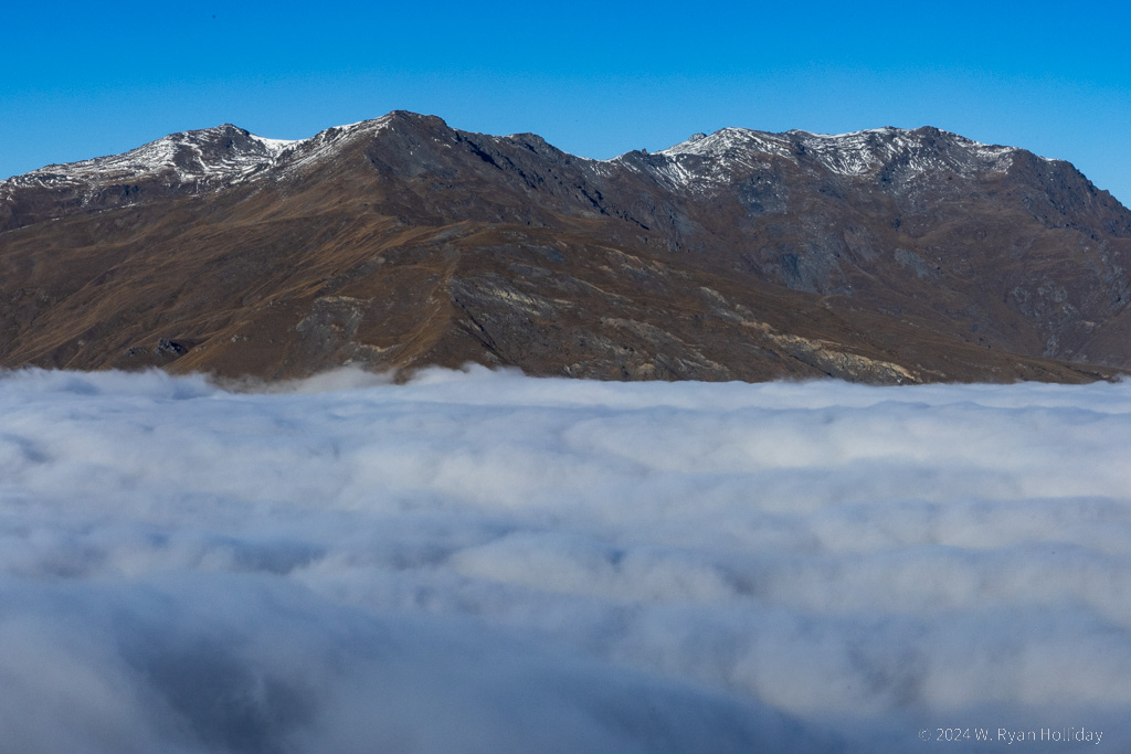
Clouds and Mountains Near Queenstown

This scene of clouds and mountains north of Arrowtown was hugely fun to photograph, but it was a bit of a brown trousers situation driving in near-zero visibility on the switchbacks leading to this point this morning.

Fall Color in March

Posted from Arrowtown, New Zealand at 11:33 am, March 30th, 2024

Arrowtown is apparently one of, if not the best spots in New Zealand for fall colors, and I randomly happened to end up here under blue skies as the show was starting. The karma gods clearly have me mixed up with someone else, but I’ll take it.

Today was another day of hiking, first on the unfortunately-named-but-very-scenic Sawpit Gully Walk, and later on a two hour loop around Lake Hayes. New Zealand always seems to denote trail distances in hours rather than kilometers, which makes sense when a handful of trails are flat and the rest are vertical death marches, and thus a 5 km flat trail might take 1 – 1.5 hours, while a 5 km uphill climb of doom is more likely 2 – 3 hours. They also rate their trails as “easy”, “intermediate” or “advanced”, which so far as I have discovered means the following:

  • Easy – A walking trail that is dead-simple to navigate and that will be designed and maintained to standards that would meet or exceed those expected of the best US Interstate Highway. The trail might be long and might have a few minimally challenging sections, but you probably won’t notice because the scenery will be so great.
  • Intermediate – A trail that is relatively easy to follow as long as you pay attention to where you’re going. There will be several long and steep sections that will cause you to get lightheaded and lose a few pounds in water weight. While hiking, expect to be passed along the trail by at least a half dozen New Zealanders out for a leisurely morning jog.
  • Advanced – A trail that may not be anything more than a goat trail, where navigation is done by following rock cairns and the blood and tears of other hikers. Expect to be using your hands for balance and support on steep sections. Advanced trails should not be attempted by anyone without survival training and hoofs. The Department of Conservation will have likely built a hut for backpackers along this trail, and it will inevitably be staffed by a lovely seventy-five year old New Zealand man who hikes the trail twice a week with 100 pounds of supplies on his back.

Thus far all of the trails I’ve done have fallen into the “easy” and “intermediate” categories (no, the vertical 2,000 stair Sealy Tarn trail didn’t make the “advanced” cut), but I’ve stared into the abyss of a few of the advanced trails and decided that I value my knees too much to sacrifice them for a slightly better view of the landscape.

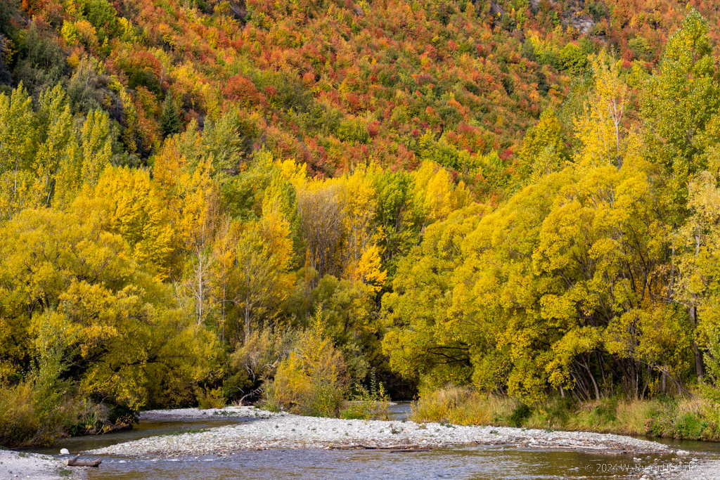
Arrowtown Fall Color

The beginning of the Fall colors in Arrowtown.

Keys Summit

Posted from Arrowtown, New Zealand at 11:28 am, March 29th, 2024

The weather this morning in Milford Sound, one of the world’s rainiest places, was picture perfect. Blue sky, barely a cloud anywhere to be seen. I’m not sure what awesome things I did in a past life, but karma is obviously paying off big time. After checking out of the lodge I went down to the harbor one last time to enjoy the sun on Mitre Peak; I don’t know if I’ll ever be back here, but if not I want that memory to stick around for as long as possible.

From there I started up the Milford Road towards Te Anau, with plans to do some hiking. A few of the trails along the way were rumored to turn to utter muck after rains, so I ended up skipping them and choosing the road’s most popular trail, which follows a section of the Routeburn Track up to Keys Summit. Amusingly the sign at the trailhead warned that “snow can occur anytime on this trail, even at Christmas“; Bing Crosby probably had one less hit song in the southern hemisphere.

The full Routeburn Track is a multiday trail through the mountains, but the section to Keys Summit is a three hour round trip through lush rainforest and up to a summit with 360 degree views of the mountains. I arrived early enough that there was barely anyone else on the trail, got to the top with views of snow-covered peaks all around, and may or may not have done a Sound of Music twirl in celebration.

After returning from the trail it was a scenic drive back to Te Anau, which at two hours driving distance is the nearest town to Milford that has any services. While there was a restaurant at the Milford Lodge, I skipped it since the food was pricey and not anything I was excited about, so meals for the past three days have been mainly trail mix and a falafel sandwich during the scuba trip. Arriving back in town, I wanted something that was neither nut nor falafel, and thus ended up ordering a steak sandwich at a busy cafe. The six inch tall sandwich that arrived had an actual steak in it, wedged between two pieces of homemade ciabatta bread, with a fried egg thrown on for good measure, and, like a few other meals on this trip, it is very important that my doctor does not hear about it before my next cholesterol test.

Long ago the plan for tonight was to stay in Wanaka, but this weekend it seems like half of New Zealand is descending on that town for the Warbirds Over Wanaka airshow, with lodging having been booked months in advance, so instead of Wanaka I’m 55 kilometers south in the old mining town of Arrowtown. It’s unexpectedly pretty here, with trees everywhere changing color for fall, so it might have actually been a fortunate accident that Kiwis are apparently airshow fanatics.

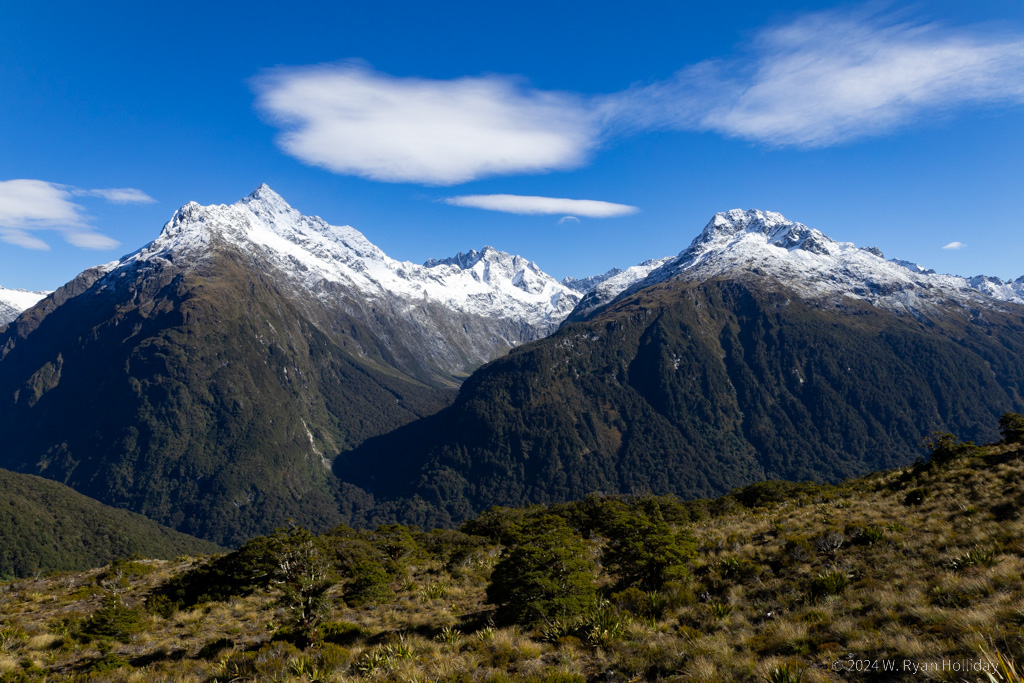
Keys Summit View

View from Keys Summit.

Ball Birds

Posted from Milford Sound, New Zealand at 11:21 am, March 28th, 2024

After yesterday’s scuba adventures, today was quite tame in comparison. It snowed overnight at the higher elevations, so I woke up surrounded by newly-decorated peaks. The clouds cleared throughout the day, so today’s adventures mostly revolved around walks along the water to enjoy the changing light, as well as conversations with the local weka, a species that my mom would describe as a “ball bird”; they are birds about the size of chickens that look a bit like they were assembled in Jim Henson’s creature shop, with round bodies, big feet, and stubby tails, but they made for good morning companions. With no native land mammals (aside from a couple of bat species) New Zealand has evolved some odd and fearless birdlife, and it’s been a pleasure getting to know them as they come to visit while I’ve been out hiking.

One random note about Milford: one of the informational signs along the harbor was discussing the Maori creation myths about this place. In their telling, the fjord was created by a powerful god, but upon seeing it the goddess of death feared that it was so glorious that people who came here would never want to leave, and so filled it with biting sandflies to encourage people not to stay too long. Luckily the sandflies haven’t been too bad while I’ve been here, but good thinking on the goddess’s part for planning in advance to prevent overcrowding.

The skies are (shockingly) mostly clear at the moment, with the forecast calling for more of the same tomorrow, so with any luck there should be some amazing views and a bit of hiking in the high country along the Milford Road tomorrow as I retrace my path north to Arrowtown.

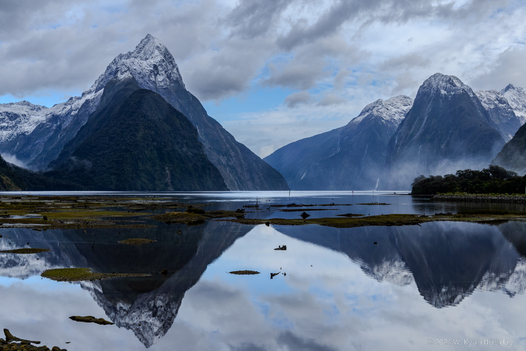
Milford Sound

Fresh snow on mile high Mitre Peak in Milford Sound.

Underwater Milford

Posted from Milford Sound, New Zealand at 11:21 am, March 27th, 2024

After thunderous wind and rain throughout the night, and despite a forecast that called for more of the same, the sun came out this morning in Milford Sound. And this place is beautiful.

The adventure for the day was scuba diving, which meant my first time in a dry suit since the water is frigid. The main diving attraction here is that due to the meters-thick layer of fresh water on the surface, as well as the steep fjord walls, the water is much darker than normal, so you get a lot of deep water species unusually close to the surface, including thousand year old black coral. But given the cold temperatures they strongly recommended a dry suit, and that was a new experience for me. I did the requisite online training a few days ago, but knew as we got in the water to practice a few key skills before our first dive that it wouldn’t be pretty. And I was right.

Unlike normal scuba, where you’re controlling your buoyancy with a BCD, they had us controlling our buoyancy by adding or removing air from the suit and mostly ignoring the BCD. That had the advantage that you’re only worrying about one set of buttons instead of two, but the disadvantage that all of your air goes to the highest point in the suit, so it was ass over teakettle if you got slightly upside down since air rushed to your feet, and you couldn’t do anything since your dump valve is at your shoulder. As the divemaster (correctly) warned would happen to just about everyone at least once, I suffered the ignominy of getting pulled to the surface towards the end of the first dive – I think I could have kicked out of it, but he kept pointing at my shoulder valve and by the time I had gotten upright to start dumping air I was a missile launching from the depths. A common refrain among the many experienced divers who were doing a dry suit dive for the first time today was that this first dive was “neat, but also infuriating”.

As we nursed our wounded pride they told us the second dive was always easier, and that turned out to be true. Whereas the first dive was mostly spent trying to figure out the equipment and how NOT to turn into an underwater runaway train, on the second dive there was a bit more familiarity with what to do and what not to do, so for me it was about 80% spent enjoying the scenery and 20% spent trying to avoid doing something stupid. The black coral (which is actually white) looks like a tree from another planet, and we also saw a large conger eel, a giant (by seahorse standards) seahorse, a small shark, and a bunch of different fish, nudibranchs, and other random marine life. The dive environment was also unique – the top 10-15 feet is freshwater from all of the rain pouring off of the cliffs, which was murky, filled with bits of leaves, and much colder than the seawater layer below. Descending, you would be totally disoriented with zero visibility and reduced buoyancy in the freshwater, then you would hit the saltwater and suddenly you could see again and manage your buoyancy normally.

Aside from the diving, the New Zealand dive crew added some local color to the trip. Cody, one of the two guides, was looking forward to the tourist season ending in a few days and getting ready for the The Great Annual Nude Tunnel Run, which is a yearly event held at the end of the season that traverses the Homer Tunnel, a 1.2 km long tunnel hacked out of solid granite 900 meters above the Sound. As one description of the event clarifies, “it’s not entirely naked because you are allowed to wear running shoes and a headlamp”, while another notes that “it’s at 10:30 at night because, well, trucks and sandflies”. In a similar vein, the skipper Carl asked if we wanted to see a shark shortly after pulling the boat out of the water. With some confusion we followed him down to the dock, where apparently a two meter long sevengill shark sometimes hangs out. He began splashing his hands in the water, but asked us to let him know when the shark was coming so he could get out of the way (side note: the shark was apparently elsewhere today). “I thought you said nothing in New Zealand could hurt you” someone said. Carl looked up, pointed at the land, and said “That’s New Zealand. It’s completely safe.” He then pointed at the ocean and smiled. “There’s stuff in there, though, that will take your leg right off”.
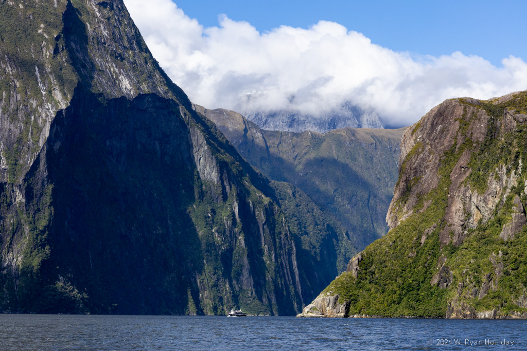
Milford Sound

Milford Sound, double-decker boat for scale.
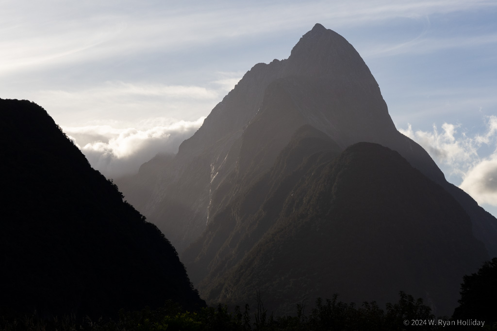
Milford Sound

End of the day at Milford Sound.
The Road to Milford Sound

Posted from Milford Sound, New Zealand at 11:36 am, March 26th, 2024

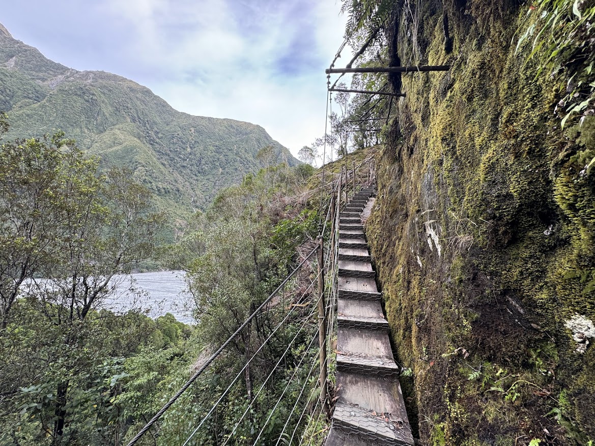
Milford Sound is one of the wettest places on the planet, with rain 182 days per year, and a total of nearly two feet falling each month. Unfortunately today was no exception, so while the myriad waterfalls cascading 1000 feet down the cliffs were a sight to see, the views that the road and the Sound are famous for were mostly obscured. Fortunately I’m here for three nights, so with any luck the sun will come out at some point.

From what I could see, the road to Milford Sound may be a bigger star than the Sound itself. Driving here is a bit like driving through Yosemite Valley, except that everything is covered in rainforest, there are ten times as many waterfalls, and at the end of the road you’re at the ocean. The valleys are deep, glacier-carved wonders like in Yosemite, with steep sides that rise up into the clouds. I managed a few short hikes in between storms, and while there aren’t sequoias or other huge trees, the rainforest has its own charms, with dense vegetation and mosses, ferns, orchids, and all manner of other greenery growing on every rock, tree limb, or any other available surface.

As I’m typing this from my cabin at Milford Lodge, there’s a thousand foot waterfall coming down from one cliff face to the north, and I can see five more waterfalls from my window on the mountain to the south. I’m sure the Sound is impressive, and I’ll see it more fully tomorrow during a scuba trip, but the valleys and mountains around here definitely deserve accolades of their own.

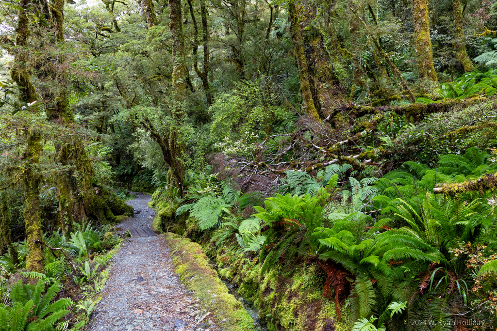
Fiordland National Park Rainforest

Milford Sound gets seven meters of rain each year, which is nearly two feet each month, which leads to very lush rainforests.

Cows in Paradise

Posted from Glenorchy, New Zealand at 12:02 am, March 25th, 2024

I expected there to be a few wet days in New Zealand, and the first one started last night with rain pattering on the roof until morning. Luckily it stopped before sunrise, and a brisk wind came up that mostly dried things off, so first thing this morning it was off to the far end of Lake Wakatipu for a hike at the Glenorchy Lagoon boardwalk. The night’s precipitation meant that there was a fresh dusting of snow on the surrounding mountains, and it made the landscape feel especially Middle Earth-y (it also helped that this area was used to film a ton of scenes from LOTR).

Following the morning’s blissfully stair-free hike, I noted that the map labeled the road as the “Glenorchy-Paradise Road”. Never one to pass up an opportunity to visit Paradise, I set off away from the lake and into the mountains, across a small river that flowed over the road (apparently it didn’t merit a bridge), and to the tiny “town” of Paradise. “Town” is used loosely here – so far as I could tell, it’s a couple of farms and a lodge – but the town sign is supposed to be one of the most-photographed signs in New Zealand; as you look out across a beautiful valley, snow-covered mountains behind it, it makes sense that there would be an empty road with a sign that says “Paradise” next to it. While I was stopped to enjoy the view, three of the locals wandered over to chat, and we discussed the day’s activities for a bit before they licked me, mooed, and then continued to chew their cud.

The afternoon forecast called for more rain, so after stopping at Mrs. Woolly’s General Store for another meat pie (I’m somehow on an all-meat-pie diet now) and a quick hike to photograph the encroaching storm over Lake Wakatipu it was back to the Little Paradise Lodge. After feeding the peacocks and chickens, time spent getting to know their nine-foot long New Zealand longfin eel, and another stroll around the grounds to enjoy the garden, I called it a day. Tomorrow it’s a four-ish hour drive south to Milford Sound, and with any luck the weather will be cooperative since it’s supposed to be one of the most scenic drives in the world.

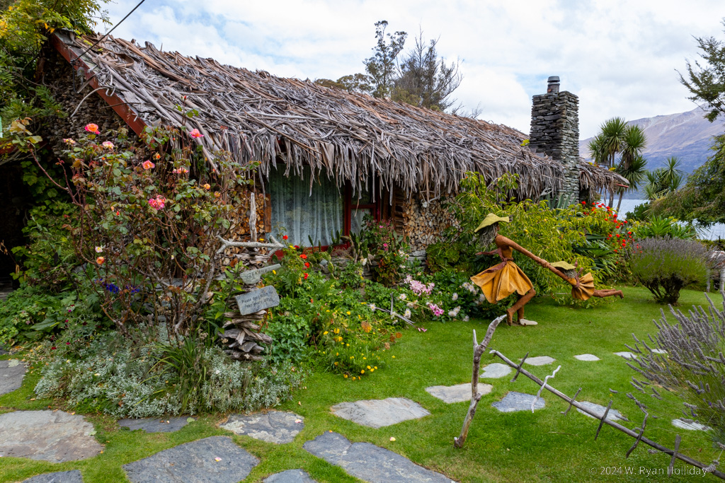
Little Paradise Lodge

Little Paradise Lodge and a tiny bit of the garden.

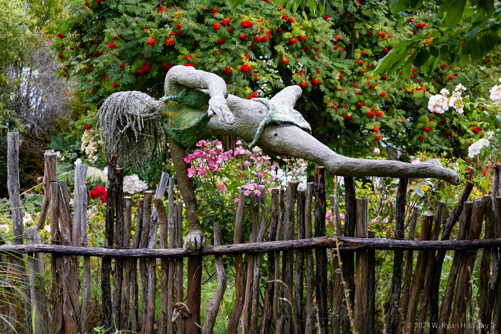
Little Paradise Lodge

One of the many, many life-sized statues at the lodge. The owner clearly loves the exuberance of life, and it’s a fitting theme in his lush garden.

Little Paradise

Posted from Glenorchy, New Zealand at 12:07 pm, March 24th, 2024

The stargazing trip ended at 11:15 last night, so it was well past bedtime when I finally got home, and I was asleep within seconds. This morning was the last chance for a hike in the park, so shortly before sunrise I got up and embarked on the 1000 steps of the Red Tarn Track. It was utterly quiet as the sun was starting to illuminate the mountains, and I only saw six other people on the trail. Afterwards I took an inventory of my leg muscles to determine how well the rowing machine that I use at home had prepared me for three days of hiking in the mountains. My quads and (surprisingly) knees were both still on full speaking terms with me. My hamstrings were complaining but still amicable. My calves, however, had fully gone on strike, and all that was left in their place were raw knots of pain and anguish.

After saying a sad farewell to Aoraki it was off to the south, stopping along the way at High Country Salmon’s farm and main shop south of Twizel for lunch. From there it was a scenic four hour drive through pastures, hills, gorges and lakes until I reached Queenstown, panicked momentarily at seeing humanity again, and then quickly exited west towards the night’s lodging at Little Paradise Lodge.

I’m not totally sure how to describe the evening’s lodging. It’s a bit like Willy Wonka opened a four bedroom guesthouse surrounded by gardens. Everything (including the two buildings) is handmade from rocks, sticks, or other natural materials, there are thousands of flowers planted everywhere, dozens of unique statues made by the owner have been placed throughout the property, there are a handful of ponds and fountains, and there are random details in every corner that cause you to do a double take. I’m writing this from the “Fire of Romance” room (Audrey was unsurprised that I booked the romantic accommodation when she’s still at home) with a half dozen peacocks chattering outside, a view out over the massive Lake Wakatipu, and rain pattering on the ivy-covered roof.

Mount Sefton

Mount Sefton from the Red Tarn Track. This mountain rumbles multiple times a day as a chunk of glacier falls off of its slopes.

A Day Without Stairs

Posted from Aoraki / Mount Cook National Park, New Zealand at 11:32 am, March 23rd, 2024

After yesterday’s many hikes I figured I’d take it a little bit easier today, and started the day after sunrise for the first time so far on this trip. The morning’s destination was to an overlook of the Tasman Glacier, which at 24 km in length is New Zealand’s largest. Unfortunately, since the 1990s it has been retreating at a rate of about 200 meters every year, and while I remain optimistic that we’ll remedy the climate change issue at some point, it’s still sad to see such a massive force of nature and know that we’ve lost over three miles of it in my lifetime.

While visiting the glacier and the large lake at its face there was a constant sound of flightseeing planes and helicopters overhead, and only while hearing that did I realize how absent the sound of aircraft has been on this trip. I suppose that New Zealand isn’t under many flight paths, but it’s been nice having stillness that is seldom interrupted by anything other than birds flying overhead.

After a short rest, the plan for the afternoon was to hike the Red Tarns Track, which unlike the Sealy Tarns Track has only about 1000 steps. However, while walking to the trailhead I noticed that the mountain was out and showing off under clear skies, and since I didn’t need a lot of convincing to skip another brutal cardio workout it was off to the Hooker Valley Track for the third time in two days. Today I reached the trail during Saturday afternoon rush hour, but even having to weave between people every minute didn’t take away from the awe on this route. What’s more, the mountain was being fully cooperative, and I arrived back at my lodging five hours later with a huge number of mountain pictures to sort through.

Tonight I’m off on a stargazing trip (this area is part of a dark sky reserve since it has nearly zero light pollution), and the plan for tomorrow is to give the Red Tarns stairmaster Track a try before sadly leaving the park and heading south to Glenorchy.

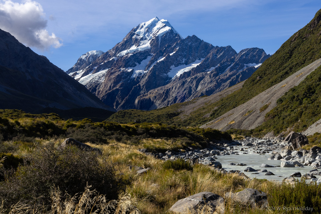
Aoraki / Mount Cook

Aoraki / Mount Cook from the Hooker Valley Track. It was a pleasure spending a few days getting to know you.

I Am Good Tired

Posted from Aoraki / Mount Cook National Park, New Zealand at 12:35 pm, March 22nd, 2024

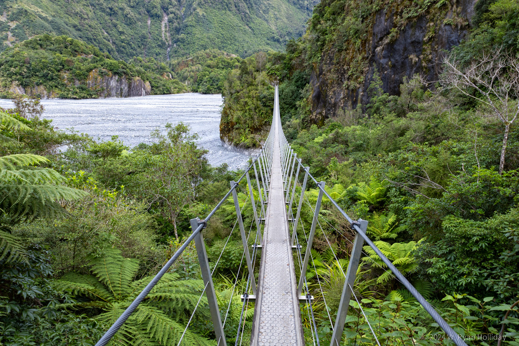
There are a few things on this trip that I didn’t want to miss due to weather or some other snafu, and so booked multiple days at a location for insurance. One of those “must-do” items was the Hooker Valley Track in Aoraki / Mt Cook National Park, a hike through a glacial valley past hanging glaciers, across wire suspension bridges that span roaring glacial rivers, and ending (on clear days) at a glacial lake with a view of Aoraki / Mt Cook rising up into the clouds. Waking up well before sunrise this morning, the skies were mostly clear, so thirty minutes before the sun was supposed to come up I set off on one of New Zealand’s most popular trails with the peaks of the mountains starting to turn red. The word “epic” can be overused, but this trail deserves the superlative; everywhere you look are vertical, glacier-covered mountains, multiple turquoise lakes collect runoff, and three 200 foot long suspension bridges shake and bounce as you cross the rivers. The trail more than lived up to expectations, and as an added bonus there were a dozen kea (large green parrots) at the trail’s end. These birds are nicknamed the “clowns of the mountains” and are insatiably curious. While one was attempting to untie my shoes, another was peeling stickers off of a sign, while others were fighting over tissues they had found, all while incessantly chattering and bickering with one another.

As clouds began to obscure the mountain I finished the three hour out-and-back trail, and after a short break decided to give the Sealy Tarns Track a go. This trail offers spectacular views, but unlike the Hooker Valley Track it is not an “easy” trail, instead consisting of 2200+ steps as it rises vertically through a 1600 foot gain in elevation. Whoever built and maintains this track deserves some sort of lifetime achievement award, because the trail was in excellent condition, but for nearly two hours of hiking, life is a brutal stairmaster as you trudge up step after step, pause to catch your breath (and enjoy the ever-improving views), and then continue the long slog upwards. As advertised, the views of the valley and surrounding glacier-covered mountains were awe-inspiring, but it was with a great deal of relief when I finally reached the tarn (pond) at the top and got to sit and enjoy the quiet, interrupted only by the conversations of some other hikers and the occasional small avalanche on the nearby glaciers.

After descending the stairs and making one last short detour on wobbly legs to Kea Point (no keas there, but it did have a pleasant view over a glacial lake) I returned to my lodging, grabbed a shower, and decided to call it a day. Until, that is, I noticed that the clouds that had been covering Aoraki / Mount Cook since morning had parted, and the late afternoon light was illuminating the mountain perfectly. And thus it was that I ended up hiking the Hooker Valley Track twice in one day, the second time at a brisk pace to try to beat the next round of clouds. The mountain was uncovered by clouds and showing off for the first two-thirds of my hike, although by the time I reached the trail’s end the clouds had again begun to move in. Still, tired as I was, the trail was just as beautiful the second time, and the return journey was made under red skies as the sun set.

Harry Chapin used to tell a story about his grandfather discussing “good tired” and “bad tired”. He describes “bad tired” as a day that wore you down fighting other people’s battles or fulfilling other people’s agendas, and “good tired” as a day that took everything out of you, but did so while you were chasing your own dreams and desires. I’m going to bed exhausted tonight, but I am good tired.

Kea, clown of the mountains

The kea are a tourist favorite but a nuisance for the locals. They will steal anything you leave behind, investigate everything they see, and constantly chatter to one another about the day’s gossip.

Landscape, Aoraki Mount Cook National Park

View from atop the stairs of doom. It’s incredibly scenic (and painful) as you climb up several thousand steps above the valley. The path actually continues upwards from the Sealy Tarns to Mueller Hut, but the stairs end at the tarn and I’m told from this point onwards you’re scrambling up loose rock, so I chose not to continue the cardio workout and merely enjoyed the view from this point.

Aoraki / Mount Cook rising from the clouds

Aoraki didn’t have great light on it when I visited at sunrise, and at sunset the clouds had again begun to close around the mountain, although the summit was lit up up rather beautifully.

Fresh Mountain Sashimi

Posted from Aoraki / Mount Cook National Park, New Zealand at 10:10 am, March 21st, 2024

Tonight’s lodging is in the shadow of Aoraki / Mt Cook, which at 3,724 meters (12,218 feet) is the tallest mountain in Australasia. The park is also home to 19 of the 20 peaks in New Zealand that are taller than 3,000 meters, and its 273 square miles are 40% covered in glaciers, so it’s quite the alpine destination. I arrived a bit late in the day to do much exploring, but if the weather forecast holds I’ll be wearing some holes in my hiking shoes over the next two days.

The journey to get here traveled through an area known as the Canterbury Plain, which one guidebook described as “scenically deprived”, and of which Hugh (half of the proprietorship at the Coombe Farm B&B) noted “not much to see along that route”. I thought the five hour drive up through farmland and fields was rustic and charming, but as warned, there weren’t a lot of compelling places to stop for the first several hours.

The first recommended opportunity to get out of the car was in the tiny town of Fairlie to visit the Fairlie Bakehouse. The town itself didn’t seem that notable – main street, lots of shops, a park – but the bakehouse is mentioned in every guidebook, and was the one place both Hugh & his wife Kathrine said to visit. The shop is famous for their meat pies, and while as an American I don’t know much about pies made of meat, I’ve got to say I bought three of them for the equivalent of about $5 USD each (flavors: meatball & mushroom, butter chicken, and vegetable curry), and I got an extremely tasty lunch, dinner and future breakfast out of the bunch.

After leaving the plains the scenery became more dramatic, first with glacier-fed Lake Tekapo appearing against a backdrop of mountains, followed by the even more impressive sight of Lake Pukaki surrounded by glacier-covered peaks. I made stops at both lakes, and at the second also visited a place that I had highlighted in my guidebook. High Country Salmon, located as far from the coasts as you can be in this country, supposedly boasts the best salmon sashimi in New Zealand, so I had to give it a try. They have nearby fish farms fed by glacier water, so it’s fresh as can be, and while salmon isn’t normally my goto sushi, I went back and bought a second takeaway portion after the first helping, and will probably be visiting them again in a few days after leaving the park.

Landscape, Aoraki Mount Cook National Park

The focus in Aoraki Mount Cook National Park is on the glacier-covered behemoths, but the soft light on these lesser peaks caught my eye, and since there will likely be an overload of glacier photos in the next few journal entries the B-players can take center stage today.

Extinct Volcanos

Posted from Akaroa, New Zealand at 11:23 am, March 20th, 2024

The trip wasn’t supposed to start on the Banks Peninsula. Originally the plan was to arrive in Christchurch and head up the mountains to Arthur’s Pass to do some hiking. However, there aren’t a lot of lodging options up there, and of the ones I liked, the first one was fully booked by a tour group. The second was being renovated and their website has said “opening later this year” since last October. There was one other I liked, an Airbnb, but from its description I got the distinct impression that the owner was lonely and renting out rooms to entice company to stay with her. And thus it was that my attention shifted from Arthur’s Pass to the extinct volcanoes surrounding Akaroa.

I woke up well before sunrise this morning, and after checking the tide charts made an early departure for the Onawe Peninsula, a landmass that is probably no more than 200m wide at its widest point, that juts nearly a mile out into the ocean, but that is cut off from land as the tide rises. There’s a 250 foot hill near the end with the remains of a Maori Pa (fort), and amazing views of the harbor. All in all a pretty nice place to watch the sunrise and a really nice way to start the day.

After returning to the B&B for a breakfast of bacon, eggs and sausage that my cholesterol-obsessed doctor must never hear about, it was off to the Hinewai Reserve, over 3000 acres of what was mostly former farmland that has been restored since the 1980s to native vegetation, much of it by a man named Hugh Wilson who is now in his 70s, still travels everywhere by bicycle, and who I assume is responsible for the signs throughout the reserve that ranged from a “max clearance: 1.65m” sign next to a portion of the trail with a low overhanging branch, to a warning about “no intelligent life” being found in cars (there was something about someone backing over some bushes), and a poignant one noting that a botanist cries every time a hiker carelessly breaks a fern frond. Aside from the signs, there were miles of walking trails through the dense rainforest, and it was a joy to walk through woods filled with plants and animals that were wholly unfamiliar, although I’m likely to be a bit stiff tomorrow after 20,000 steps through mostly vertical terrain.

The day concluded with a visit to pet a few of the local sheep (the B&B sits on 1200 acre farm), another short-ish hike up to a waterfall near the B&B, and a dinner of seared tuna and scallops in town. Tomorrow it’s off to the “Southern Alps” for more hiking, glacier viewing, and stargazing.

Two more items for the record. First, I only turned on the windshield wiper when trying to engage the turn signal about fifty percent of the time today, so there may yet be hope that I can learn to drive on the left without being a menace to others. Second, in case anyone is wondering, as far as I can tell the water in the toilet bowl goes in the same direction as it does in the northern hemisphere when flushed. Mark Rober can provide the science debunking that particular myth, but I was still kind of hoping to see the water going the wrong way.

Banks Peninsula Satellite Image

In case anyone is wondering how I chose to visit the Banks Peninsula, I was looking at the map and said “what is THAT???” Photo credit: NASA via Wikimedia Commons

Silvereye, Hinewai Reserve

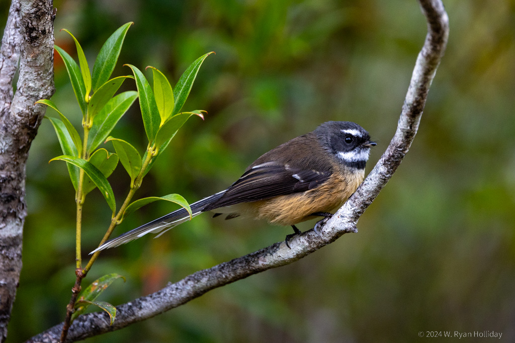
Silvereye in Hinewai Reserve. Bear with me while I learn the names of the birds here through my magical process of “photograph it and upload the photo to Google image search to get an ID”.

Goblin Forests

Posted from Akaroa, New Zealand at 10:23 am, March 19th, 2024

And so it begins. The flight to Christchurch was probably the emptiest large plane I’ve ever been on, and just about everyone had their own row to stretch out and sleep on. The flight attendant says the return flights are full, but it’s the end of the season and they actually stop this service soon so very few people are going TO New Zealand, which bodes well for avoiding crowds while I’m here.

After passing through customs and getting my rental car, the initial shock of driving on the left and trying to figure out another country’s traffic rules was compounded by the fact that the “compact” SUV that I expected would be about the size of my Subaru was considerably larger, so in addition to accidentally turning on the windshield wipers every damn time I wanted to use the turn signal, I also had to figure out how to navigate what felt like a small boat through the streets of Christchurch. My chosen route was away from the highway and along curvy roads on a long-dormant volcano, which added to the fun. As the roads got narrower and curvier the farther I traveled from the city, it was actually with a bit of relief that I eventually turned on to a sketchy, one-lane dirt road with hundred foot drops on one side, since at least I didn’t have to think about which side to drive on any longer.

The route was incredibly scenic; I’m not quite sure how to describe it, but the myriad turquoise blue inlets felt a bit like fjords, except that they were surrounded by steep grassy hills with the occasional volcanic outcropping sticking out. The route would hug the water for a bit before climbing steeply up to an amazing view, then drop down to the next inlet. Surprisingly, when I first got to the water I saw a bunch of geese, and was excited to start getting familiar with the local birds. Then I got closer: Canada geese, a species that is more well-traveled than I am.

After getting closer to my lodging for the evening I detoured up to the Otepatotu Scenic Reserve, which was on the crest of the volcano and offered expansive views. There was a short hike up to the very top of the summit that went steeply through what the guidebook described as a “goblin forest”. The dense woods was full of mossy trees, ferns, and tiny birds, and while it was incredibly goblin-y, I failed utterly at finding the mythical monsters.

The final stop for the day was at my farmhouse B&B. As I was pulling up the road to the house I saw four beekeepers, and stopped briefly to figure out how to proceed. One of the beekeepers started walking towards me, with a swarm of angry bees circling her. As she got closer I warily rolled down my window to see what she wanted, at which point she told me “Be sure to keep your windows up, there’s loads of bees about.”

Akaroa Harbour

Akaroa Harbour from Otepatotu Scenic Reserve (try saying that name five times fast).

Until We Meet Again

Posted from Culver City, California at 11:53 am, September 11th, 2022

Our trip has sadly come to an end; after driving through Hilo and across the Saddle Road, we flew out of Kona and arrived at LAX at 11pm last night. It was an amazingly fun two weeks of manta rays, sea turtles, rainforests, and volcanoes.

Two days ago we made a visit to the impressive Punalu’u Black Sand Beach, luckily arriving early in the day before we had to heed any warnings about the sand notoriously being so hot that it causes first-degree burns. From there we headed to the southernmost part of the island, which is also the southernmost point in the United States, and home to strikingly pretty coastline, a huge number of horses and cows, and one particularly ornery donkey.

Our final event of the day was a late-night return trip to the Kilauea crater. We were initially turned away before the trailhead by a ranger due to crowds, but that detour turned into an opportunity to visit the Volcano House for a cocktail and viewing of the volcano from a different vantage. We returned to the trailhead about two hours later at around 9pm to hike out to the lava lake overlook, and took a few million photos of erupting lava under the full moon.

Kilauea crater at night
Kilauea crater lava lake. My 400mm lens was again popular with everyone at the overlook who wanted to see lava close-up.
Kilauea crater at night
Kilauea crater nighttime landscape. I wish we could say we were smart enough to have planned to be there while the full moon was illuminating the landscape, but apparently we were just very lucky on this trip.