Ryan's Journal

"My life amounts to no more than one drop in a limitless ocean. Yet what is any ocean, but a multitude of drops?" — David Mitchell

The Day of Many Stingrays

Posted from Whangarei, New Zealand at 11:13 am, April 24th, 2024

Day two of diving in the Poor Knight’s Islands was done with absolutely perfect weather – the guides even commented that on a day like this, they might have come out to the islands if they weren’t already working. We had a smooth hour long ride out, and then just before arriving a divemaster came over to let me know that I was one of the few people on the boat without an advanced certification – I’ve never needed it anywhere so never bothered to do it – and as a result I would have to go out in a group with several newly certified divers today. This development was not a good one.

In fairness, everyone was a beginner at one time – I just had to go through it during my first dry suit dive, and I’m sure when I was new to diving that I was put in a dive group that dreaded having me with them; I’ve been going on and on about how karma has treated me well on this trip, so today it was my turn to earn some back. As expected, we got in the water, descended, and madness ensued. One diver disappeared straightaway, and the divemaster-in-training and divemaster-with-nineteen-years-of-experience had to go after her; I learned later that she’d had a panic attack, and I think she rejoined the dive after a short time calming down at the surface. From there it was a bit like the Keystone Cops underwater, with some people horizontal, some vertical, various people randomly sinking or floating away as they worked out how to control buoyancy in the thick wetsuits, and with the divemasters like sheepdogs chasing after strays and herding the flock back together. The one advantage of diving with the newbies is that they all blew through their air within thirty minutes and had to return to the boat, so as the only diver in the group still able to breath underwater, I got my own personal dive guide for the last thirty minutes. It turns out that Matt (the experienced divemaster) has a superpower whereby he can blow bubble rings that drive the fish mad, so we spent the last several minutes of our dive watching fish chase and attack bubble rings right in front of our faces.

For the second dive they thankfully switched me to a more advanced group, and that dive was entirely spent enjoying the underwater scenery. We started at a small cave, the guide shined her light inside, and a large stingray swam up one wall, across the roof of the cave, and then out over our heads. This encounter was to be only the first of probably a dozen stingray encounters on this dive. Practically every time we came around a corner there was a stingray in the kelp, or swimming through the rocks. I’ve seen them on dives before, but I don’t recall ever seeing this many on one dive. In addition there were some decent sized schools of fish that appeared totally unfazed by the humans swimming next to them, and I came away better understanding why the Poor Knight’s is such a renowned dive spot. It’s a very healthy marine environment, with a huge variety of fish that seem to care not one bit about the people swimming with them, and I suspect that every dive site is just a little bit different. We didn’t see any sharks or the massive schools of fish that you hear about in these islands, but the fact that every dive is a roll of the dice where something amazing might show up makes this a place that I would enjoy coming back to.

But if I do come back I might do so in the summer when it’s a little less freezing, and also get whatever certification the New Zealanders think is needed to avoid having to dive with the newbies 🙂
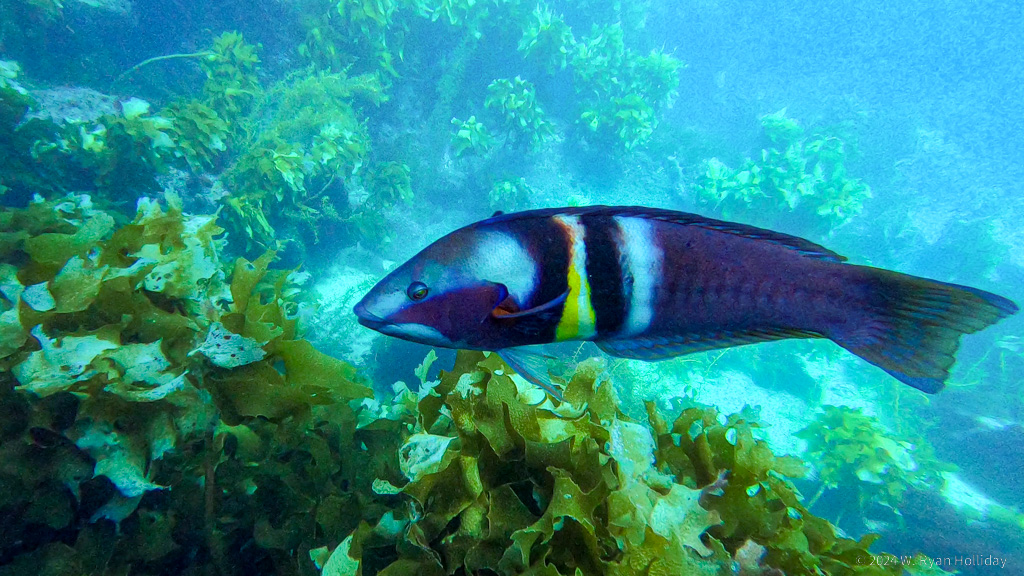
Sandager's Wrasse, Poor Knights Islands

Sandager’s Wrasse. He cared not one bit that I was a foot away filming him. For scale, he looks giant in this photo but was probably less than a foot long. Frame capture from my GoPro video.

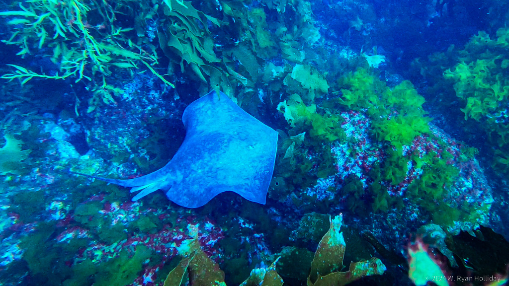
Stingray, Poor Knights Islands

One of the day’s many big stingrays. He was maybe 3-4 feet long. Frame capture from my GoPro video.

Poor Knights

Posted from Whangarei, New Zealand at 11:28 am, April 23rd, 2024

I usually dive in warm places, last month’s dive in Milford Sound being the rare exception. I got certified long ago in Malaysia, and Audrey and I have done trips to Mexico, Hawaii, Bonaire, etc; we live in California, but I’ve never dived there since the water is cold. However, I may never return to New Zealand, and the Poor Knights Islands are supposed to be an amazing dive spot, so today I donned a 7mm wetsuit, a hood, booties, and all manner of other gear that didn’t really keep me very warm, and jumped into one of the world’s premier dive destinations. The water was clear, the kelp was vibrant, and the fish had no fear whatsoever of the humans shivering in their domain.

We didn’t encounter any of the massive schools of fish that the islands are apparently famous for, but as my first time diving in kelp it was nevertheless a good day. Despite not seeing huge schools, we did see a lot of fish, most of which were new to me. The terrain is that of an ancient volcanic caldera, including caves and tunnels that made for a neat topography. Above water we visited a sea cave that is apparently the largest by volume in the world, and the dive boat drove into it with room for probably ten more boats to fit.

The day’s first dive was on the sunny side of the island, and I came out of the water thinking that the cold wasn’t actually that bad, but the second dive was in the shade of a tall cliff, and I came out of the water from that dive thinking that if I ever dive in chilly waters again, my new dry suit certification might come in handy. We motored back under sunny skies, and after a night with the electric blanket cranked to its highest setting I’ll be heading out with them again tomorrow to see what other surprises these islands might be hiding.

After returning to my accommodation for the evening I ran into the older lady who runs it, and she is a bit of a character. When I mentioned that the diving left me so cold that I couldn’t feel my insides, she immediately said “Right then, go take a shower. Or do you need a bath? I’ll let you use my bath in that other room, but don’t go using any of my nice smelly stuff.” I thanked her for the kind offer, but said a shower would do the trick, although had she sweetened the deal by giving me access to the smelly stuff I might still be in that bath now.

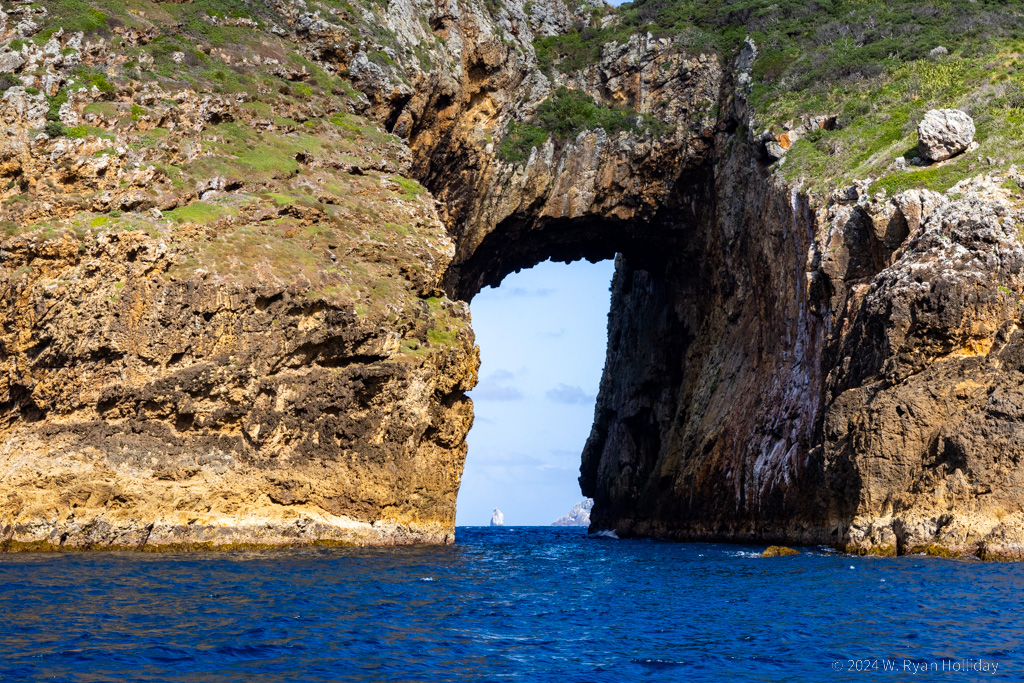
Sea Tunnel, Poor Knights Islands

The Poor Knights Islands are the rim of an ancient, 25km wide volcanic caldera, with tons of caves and tunnels everywhere you look. And for the twos of readers who want fish pictures instead of sea caves, I’ll do my best to get something up soon, but I’m tired and bad at editing GoPro videos.

Turkeys in New Zealand

Posted from Wangarei, New Zealand at 11:27 am, April 22nd, 2024

As planned, I got up early this morning, drove twenty minutes to the big trees, and… the gates at the parking area were closed until 8am. I returned later in the morning, but the first hike of the day ended up being an easy walk to the headlands above Opononi, followed by coffee and a breakfast sandwich, followed by checking out of my Airbnb, THEN followed by a short hike through the kauri trees of Waipoua Forest.

After the walk in Opononi and a visit to the largest and second largest kauri trees in the world, it was off across the country to the town of Whangarei. One oddity about New Zealand is that there are a lot of introduced species, and I’ve done double takes many times while on the road. Today I saw a flock of turkeys, a flock of California quail, and a few pheasants while enroute. It can be easy to forget you’re 6,500 miles from home when there are turkeys, quails, pheasants, pigeons, doves and Canada geese out and about.

The weather forecast over the next two days is currently calling for sun and very little wind, so with luck the diving in the Poor Knight’s Islands will be good and the ride out to the islands won’t be overly barftastic.

Big Trees

Posted from Opononi, New Zealand at 11:21 am, April 21st, 2024

One of New Zealand’s prehistoric trees is the kauri tree, which live to be a couple thousand years old and grow to diameters of 16 feet or more – smaller than redwoods and sequoias, but still very impressive. Unfortunately the vast majority of them were cut down for timber, but a few remain, particularly along the “Kauri Coast” on the northwest side of the North Island, which just so happens to be my current location. The weather has been a bit uncooperative, so while I got to do one short hike in a small kauri grove, wind and rain resulted in a new plan to get up early tomorrow to revisit the big trees before I have to check out of my Airbnb at 10am.

Somehow I’ve only got five nights left in New Zealand after tonight. Thinking back, the day of many hikes at Aoraki / Mount Cook National Park exactly one month ago feels like a lifetime has passed, but at the same time this trip has flown by. Thankfully the next five nights should be a good ending to the time here, with weather forecasts suggesting that the sun will return for a couple of days of scuba diving in what’s supposed to be one of the world’s most impressive dive sites.

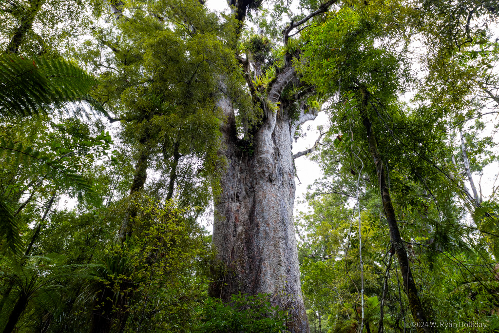
Kauri Tree, Trounson Forest Park

Kauri trees are not small, and this tree isn’t even the biggest one I saw today.

Rainy Days

Posted from Leigh, New Zealand at 11:37 am, April 20th, 2024

Rain and wind today cancelled the scuba diving, but after more than a month of daily activities it wasn’t the worst thing to lounge and catch up on errands. I got antsy towards the end of the day and went for a short hike in the mud, but otherwise there isn’t much to recap, so here are a few random observations about New Zealand:

  • In Akaroa the B&B left the key in the lock so that it wouldn’t get lost, and in Mt Cook I asked the hotel owner if it was safe to have luggage in my car while parked at the trailhead and he quite simply didn’t understand the question. At least outside of the big cities, New Zealanders don’t seem to worry at all about crime.
  • They have deer farms here. You’ll be driving along, and a herd of what look like elk will be roaming in a field. I have pulled over numerous times to get a better look, much to the confusion of other passing motorists.
  • A lot of the bridges are one-lane, with signs indicating which direction of traffic has priority. After at least a hundred of these crossings, I’ve yet to see people fail to wave in gratitude when someone is stopped to allow traffic going in the other direction to pass.
  • I’ve mentioned this before, but aside from two species of bats, there are no native mammals in New Zealand.
  • Tipping is generally not a thing. After scuba diving in Milford Sound I asked if there was a tip jar anywhere, and Cody told me not to worry about it. When I insisted he awkwardly pulled a jar out of a back shelf. People seem to take pride in doing their job and get a bit embarrassed if you offer them extra.
  • National parks have no entrance fees. They want you to be able to see their beautiful places.
  • There’s a strong culture of allowing “freedom camping” throughout the country. Even in popular tourist towns, there’s always an area with signs up denoting that you can park your camper there for the night, as long as you’re respectful.
  • They are all-in on protecting their environment. 33% of the land in New Zealand is protected for conservation, and everywhere you go you will see traps and notes about poison baits being used to control rats, possums, and weasels that are killing off the native birds and vegetation. Similarly, they have massive projects to cut down invasive pine trees and to remove other non-native plants that choke out the native vegetation.

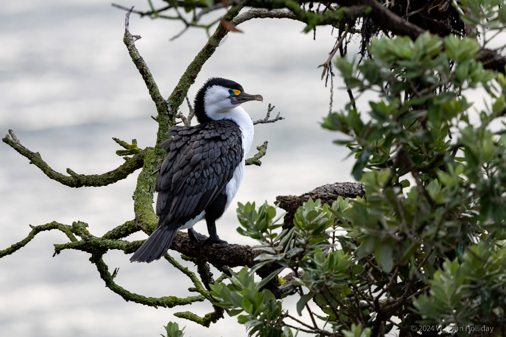
Pied Cormorant, Goat Island Reserve

Pied Cormorant, Goat Island Reserve. I only took a handful of photos today and figured this journal entry would be photo-free, but I like his green eye patch.

The Birds

Posted from Leigh, New Zealand at 12:15 pm, April 19th, 2024

Today’s adventures included a short hike to a massive 1200 year old kauri tree, watching a fisherman struggle to get a stingray off his hook (three people working as a team eventually managed to get the poor guy back to the ocean), and literally fleeing a farmer’s market after a lady at a booth spotted the tourist and came after me with a plate of samples (I’m uncomfortable around the humans). The rest of the day was mainly driving, and I survived the highways and crowds of Auckland with the only scars being mental ones.

I’m currently in the tiny town of Leigh to do a shore dive at the Goat Island Marine Reserve tomorrow. I checked in at the dive office today to get a sense of things, and they mentioned that the weather for tomorrow is “iffy” and they’d call me if the dive had to be cancelled. When I asked whether “iffy” meant one meter of visibility or ten meters, the girl at the counter cheerily said “Oh, definitely one meter. We rarely get more than three meters, but there’s loads of fish”. Tomorrow could be interesting.

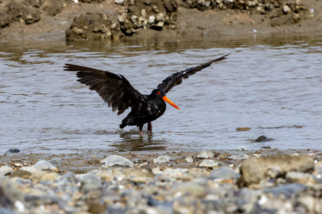
Black Oystercatcher, Coromandel Peninsula

Black Oystercatcher mid-bath, Coromandel Peninsula.

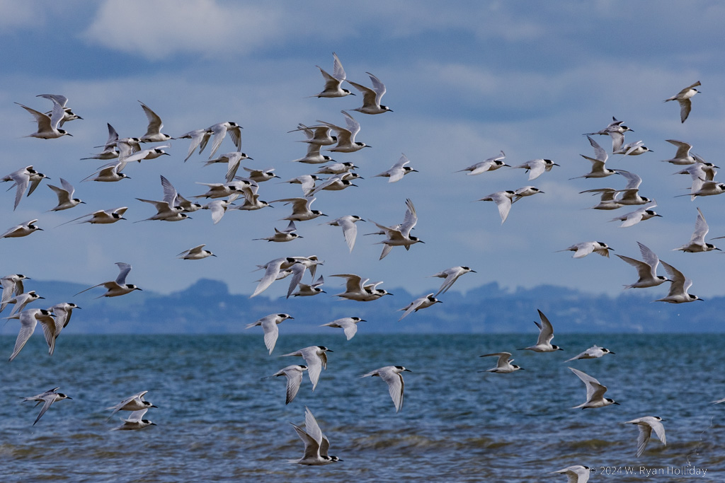
White-Fronted Terns, Coromandel Peninsula

White-Fronted Terns, Coromandel Peninsula. I’m pretty sure I wasn’t the reason they all took off at once, and they merely circled and then landed in the same spot again, but it made for a good photo opportunity.

Moving Right Along

Posted from Coromandel Peninsula, New Zealand at 11:50 am, April 18th, 2024

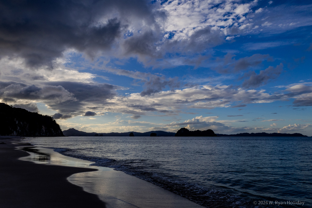
Today was a day of much driving, with a couple of short breaks along the way. Before leaving Rotorua, the lady who ran the B&B suggested I should do the hike up Mount Maunganui, a 750 foot tall dormant volcano on the coast. Never one to pass up climbing dormant volcanoes, I stopped on my way and hiked several miles up and around the big rock, taking in some rather inspiring views of the Pacific from the top. From there it was off to the Coromandel Peninsula, which is mostly farms, hills and oceans, providing some nice flashbacks to the rural scenery of the South Island. It was getting late in the day as I got to the town of Hahei, and while the trail to their famous Cathedral Cove was closed due to damage, the view from Hahei Beach as the sun was getting low on the horizon wasn’t half bad.

Tonight’s lodging is at the Buffalo Lodge, and I’ve got this huge place all to myself after a large group apparently cancelled due to Covid. It’s way up in the hills surrounded by forest, and I’m hearing a few nocturnal birds having some sort of cocktail party outside. I was hoping they might be New Zealand’s famous kiwis, but while there are supposedly kiwis around here, an interweb search for kiwi calls says the current party chatter is coming from something else – the closest match I’ve found so far is the morepork, a tiny native owl, and if that’s who’s out there talking he has a LOT to say.

Tomorrow I’m driving back through Auckland on my way further north, and despite living in Los Angeles I’ve become very afraid of traffic and people over the past month of travel, so send thoughts and prayers as I navigate highways and traffic lights again.

Sunset, Hahei Beach

Late in the day at Hahei Beach, with a few happy little clouds.

Bubble Geysers

Posted from Rotorua, New Zealand at 12:40 pm, April 17th, 2024

Today had the strangest start to any day of the trip so far, but things improved greatly from that point.

After breakfast I drove 30 minutes to the Wai-O-Tapu Thermal Wonderland, with no expectations whatsoever as to what I might encounter. They advertise that the Lady Knox Geyser erupts daily at 10:15am, which had me confused as to whether it was an actual geyser, and if so then how it could erupt at the same time each day. As it turns out, the geyser was accidentally discovered by convicts from a labor camp who saw a hot pool, decided to wash in it, and when the water got a bit soapy it induced a geyser eruption, scaring the hell out of them and causing them to run buck naked back to their camp. Today, following the lead of those convicts, park employees walk out to the geyser each morning at 10:15 while surrounded by an amphitheater full of tourists, dump a bag of soap into the cone to induce an eruption, and then begin playing music over speakers as the eruption commences with tons of soap bubbles bursting forth from the geyser like it’s a kid’s science fair experiment. Eventually the eruption turns from soapy to steamy to hot water shooting fifty feet into the air, but bubbles continue to float through the surroundings the entire time. I suppose it’s the only way to show people a predictable geyser eruption, but it still felt very, very odd. Apparently the geyser usually erupts for about an hour, but today the show lasted only about a minute, which made the experience even more of an inauspicious start to the day.

After the geyser eruption I headed over to the park’s trails, and they turned out to be much, much more normal than expected after the earlier soapy spectacle. The thermal features were all totally natural, they had a bunch of impressive mud pots and silica terraces, there were hot springs of all sorts of vibrant colors, really good and informative signage about the Taupo supervolcano, and I spent a very pleasant two hours roaming the area.

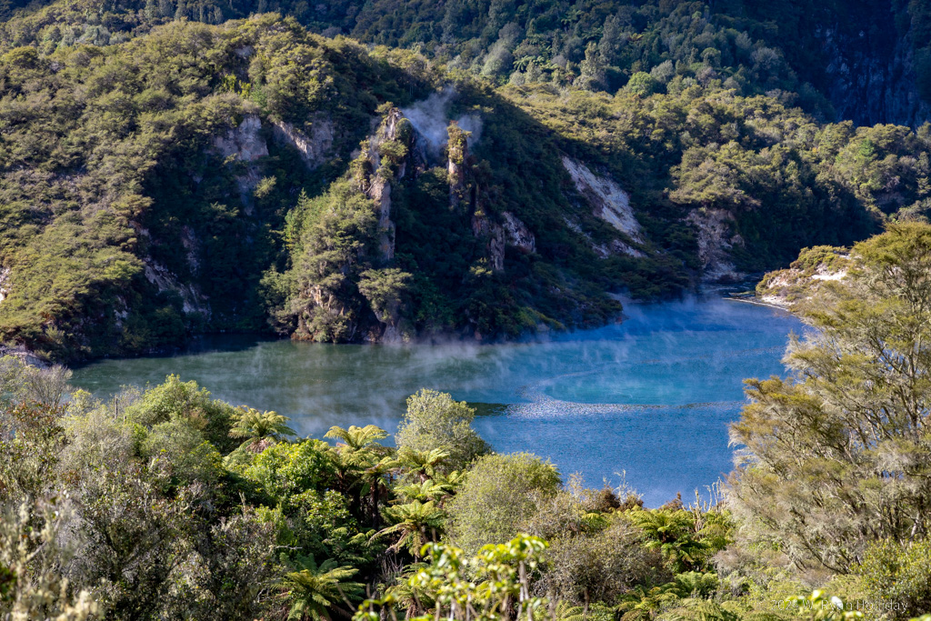
Things improved further with an afternoon journey to the Waimangu Volcanic Valley, an area formed after the 1886 eruption of Mount Tarawera. The visit is via trails through rainforest, leading past features like Frying Pan Lake, the world’s largest hot spring, and it was a nice hike with very few people around. Of particular note, the area was home to the world’s largest geyser from 1900 until 1904. The Waimangu Geyser erupted every 36 hours for 5-6 hours at a time to heights of over 400 meters, which is taller than the Empire State Building. For comparison, the largest active geyser today is Steamboat Geyser in Yellowstone, which erupts to a height of 90 meters, while Old Faithful erupts to a height of about 40 meters. As with many thermal features, earthquakes and continuing volcanic activity eventually changed the underground plumbing of the system, and the Waimangu Geyser was declared to be extinct in 1908.

Tomorrow I’m heading to the coast and up to the Coromandel Peninsula. Somehow it’s down to the last ten days in New Zealand, but there’s some diving coming up next week that should make them very memorable days.

Frying Pan Lake, Waimangu Volcanic Valley

Frying Pan Lake, the largest hot spring in the world.

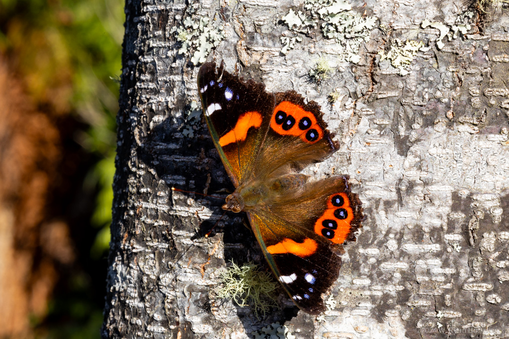
New Zealand Red Admiral

A New Zealand Red Admiral who decided to pose for pictures for a couple of minutes while I was hiking today.

Great Expectations

Posted from Rotorua, New Zealand at 12:04 pm, April 16th, 2024

I make it a general rule to try to keep expectations low; if you expect something to be the best experience of your life and it’s merely great then you’re inevitably disappointed, whereas if you expect something to be good and it’s great then you’re pleasantly surprised. However, somehow, somewhere, I had gotten it into my head that New Zealand’s geothermal features rivaled Yellowstone. I’m not sure how that happened, but when I initially circled Rotorua as a must-visit place on the itinerary I figured I’d be walking through the Southern Hemisphere’s version of Norris Geyser Basin and taking shots of the Kiwi Grand Prismatic Hot Spring. Orakei Korako Geothermal Park is generally listed as the best of the area’s geothermal parks, and I enjoyed getting to visit everything from silica terraces to mud pots, but it would have been one of those places that most people passed by without stopping on their way to see Old Faithful in Yellowstone. I also took a walk around town and saw some of the steam vents along Lake Rotorua, but again, with expectations set to Yellowstone levels, a few steaming pools were neat to see but not what I had been anticipating.

So thus it was that I headed to my lodging for the evening, thinking that this would go down as one of the merely “OK” days of the trip. After checking in the lady who runs the place mentioned that there’s a treewalk with nighttime illumination in the nearby redwood forest (quick history: 150 years ago New Zealanders planted thousands of trees of different species, including a large redwood forest, to see what might grow well and support a timber industry). California is where redwoods are native, and they are much older and larger at home than the ones here, so I was lukewarm to the idea of an after-dark treewalk, but my primary mission over this three month trip is to have adventures and see beautiful things, and you can’t do that from a hotel room, so just after sunset I walked a kilometer to the forest, handed them a ticket, and ascended 30 feet into the trees.

It was amazeballs.

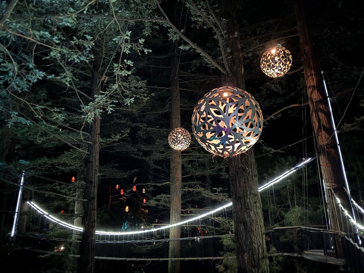
Proving again that expectations can make or break an experience, I spent two hours enjoying 800 meters of bridges and platforms suspended from redwoods, all of them 10-20 meters above the ground. Huge lanterns hung from branches to provide soft illumination in the treetops, LED lights lit up ferns on the ground, lasers made corners of the forest look like they were filled by ten thousand fireflies, and other effects made a redwood forest feel like a perfect blending of art and nature. The bridges and platforms shook with each step and provided a unique perspective on the trees. What might have otherwise been a lackluster day ended on a high note, and I got an experience unlike anything I’ve done before.

Tomorrow I’m thinking of visiting another geothermal park, this time with very low expectations, and beyond that we’ll see what other surprises New Zealand manages to serve up.

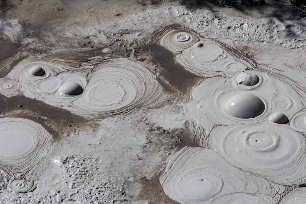
Boiling Mud, Orakei Korako

Boiling mud in Orakei Korako.

Redwood Treewalk, Rotorua

Rotorua redwood nighttime treewalk, 20 meters up in the air. Photo taken with my iPhone since the platforms were too shaky for nighttime photography with the Canon.

Tongariro Alpine Crossing

Posted from Turangi, New Zealand at 11:45 am, April 15th, 2024

Today’s hike was a one-way, 20 km trek across two volcanoes with a bit over 2000 feet of elevation gain. Since it’s a one-way trip, nearly everyone who does it takes a shuttle, and as he dropped us at the trailhead just after 7am our driver cheerfully told us “Sorry guys, that’s as far as I’m allowed to take you, you’ll have to walk the rest of the way.”

By far, the most scenic section of the trail is the volcanic crater at the top with its blue-green pools, and with the weather forecast suggesting that there might only be a couple of hours cloud-free at the summit, I decided to power up as fast as I could. With temperatures in the high 30s / low 40s I ditched my jacket and hiked at a brisk pace in just a long-sleeved shirt. I sweat like a pig at the slightest exertion, so climbing up stairs and over rocks there was a cloud of steam surrounding me as I made my way up, but emitting clouds of steam on a volcano has a certain logic to it. Luckily I got to the top in about two and a half hours with mostly-blue skies and had an hour to enjoy it before clouds started pouring over the summit and obscuring the scenery. Underscoring how important good weather is for this hike, as I was leaving the crater and clouds were reducing visibility to just tens of meters, I overheard someone else saying to his partner “Is this supposed to be the highlight?”. I owe the karma gods big time for my luck on this trip.

Having gotten to the top during today’s tiny window of clear weather I took a few photos, had lunch, roamed around a bit, and then had a leisurely stroll for the remainder of the hike. The hike overall was a fun one. You start with views of Mount Ngauruhoe (Mount Doom for Lord of the Rings fans) and hike up the bottom slopes of that volcano. Since it’s a popular trail, the Department of Conservation seems to do everything possible to dissuade people from continuing, including numerous “turn around if…” signs and a large sign at the top of the first steep climb that says “That was the easy part, it’s MUCH harder ahead”. Despite admonitions against continuing, the views get better as you climb, and after passing Mount Ngauruhoe and ascending to the top of Mount Tongariro it’s other-worldly hiking across a giant volcanic crater, with steaming fumaroles, lakes and pools that are colors that shouldn’t be possible outside of cartoons, and moonscapes of flat, rocky plains. The downhill was scenic as well, with views for miles out over the massive Lake Taupo and the surrounding countryside. I didn’t have perfect weather today, but it was pretty damn good for most of the hike and made for a grand adventure.

After the long and leisurely hike down it was only 2:30pm, so I figured why not do another short hike (I’m an idiot), and after hiking with hundreds of other people on the crossing figured an easy 6 km stroll around Lake Rotopounamu might be quieter (it was). Tomorrow it’s sadly time to move on again, but it’s only a short hop over to Rotorua, which is New Zealand’s most famous geyser and thermal area.

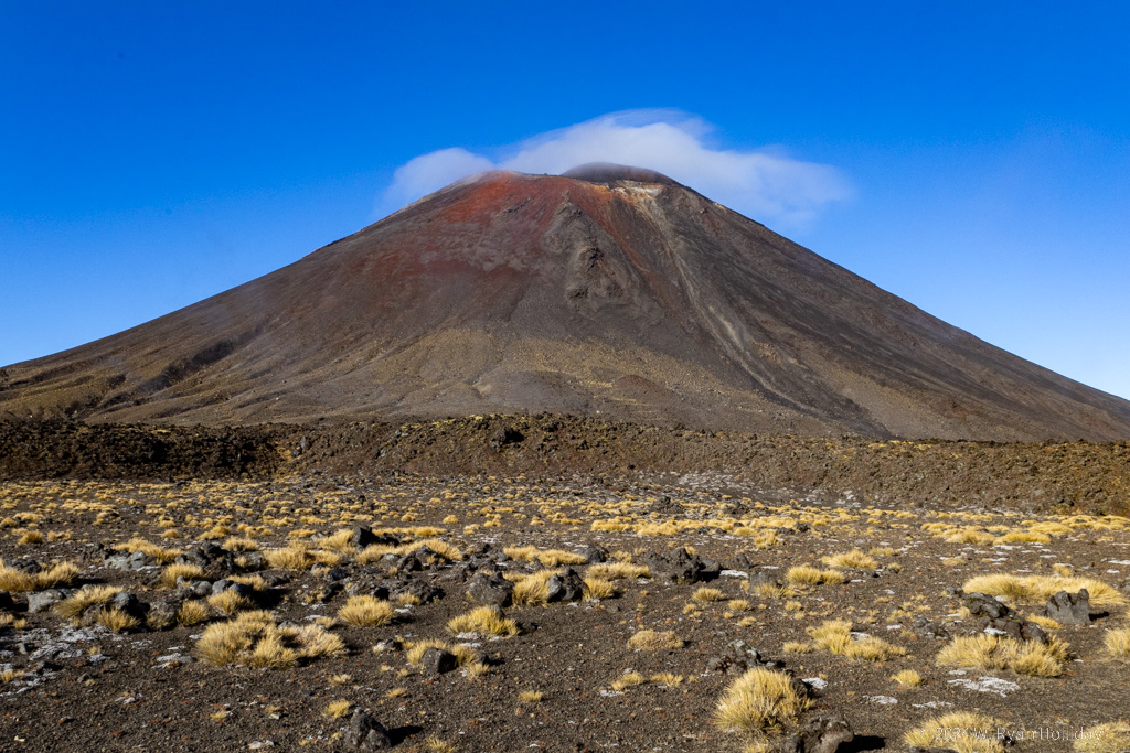
Mount Ngauruhoe, Tongariro Alpine Crossing

Mount Ngauruhoe, which played the role of Mount Doom in the Lord of the Rings.

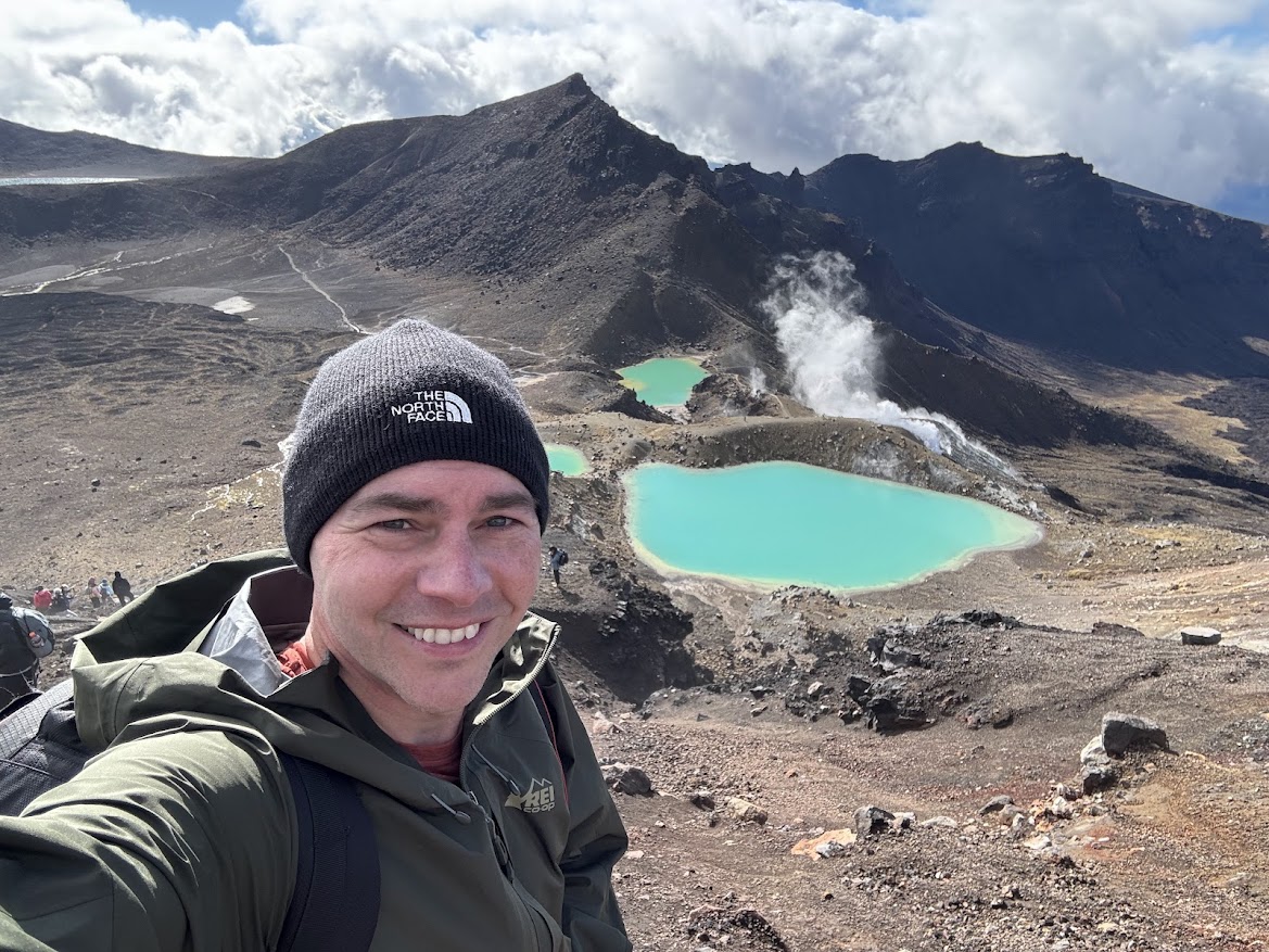
Tongariro Alpine Crossing Self-Portrait

Self-portrait above the crater of Mount Tongariro. Surprisingly the pools in the background were freezing cold, even with steaming fumaroles around them.

Tama Lakes

Posted from Turangi, New Zealand at 10:46 am, April 14th, 2024

It turns out that there is still a sun up there.

The wet stuff mostly stopped for the day today, and while clouds still partially obscured the views, after four days of rain, when I saw blue sky this morning I was amped up like a puppy ready to go for his walk. With the 20 kilometer Tongariro Alpine Crossing scheduled for tomorrow, I decided to warm up for it with the 18 kilometer Tama Lakes Track today. I haven’t gotten to go hiking in a few days, so while a smarter man might have taken it easier today, I am not such a man.

The hike was a good one. The elevation change wasn’t too bad, it traversed some neat alpine scenery, and it ended up at a high ridge with a view of the two aqua blue lakes. Various volcanic peaks occasionally also partially appeared from the clouds, hinting at some next-level glorious scenery, but the clouds never quite parted enough to get a sense of what it must be like on a perfectly clear day.

Tomorrow it’s off on what is generally regarded to be New Zealand’s best day-hike. It won’t be perfect weather, but I’m excited to be able to at least get out there and do it after such a long stretch of rainy days.

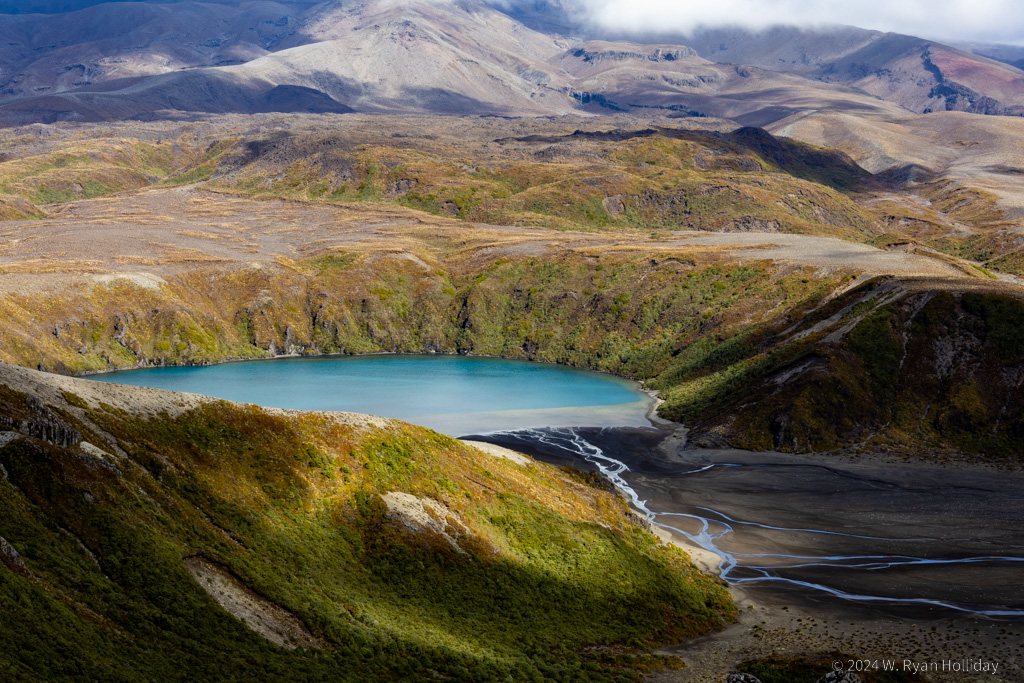
Lower Tama Lake, Tongariro National Park

Lower Tama Lake, Tongariro National Park. Both lakes formed inside of volcanic explosion craters, and two large volcanoes were looming on the horizon, partially obscured behind the clouds.

The Forgotten World Highway

Posted from Turangi, New Zealand at 11:57 am, April 13th, 2024

New Zealand’s marketing department is pretty good with naming. In another journal entry I mentioned how they’ve labeled ten hikes throughout the country as “Great Walks”, which of course makes you want to give them a try. Similarly, while leaving Auckland, I was greeted with highway signs for the “Thermal Explorer Highway”, which traverses several geothermal areas, and who doesn’t want to be a thermal explorer? Today I had several options to get from Egmont National Park to Tongariro National Park, but with one of those routes labeled as the “Forgotten World Highway” the choice was clear. Unfortunately the rain continued all day, so views were limited and I didn’t get out of the car much, but it was a neat route through an area of New Zealand that didn’t really get a functional road until the 1960s and doesn’t seem to see many visitors.

Of particular note along the way was the town of Whangamōmona, which is most famous for having declared itself the Republic of Whangamōmona during a dispute over regional boundaries in 1989. While this was more of a protest than an actual rebellion, they nevertheless immediately elected as President a resident who had been put on the ballot without his knowledge, and who served from 1989 until 1999. In 1999 he retired, and President Billy Gumboots, a goat, was elected and served for 18 months until he died in office. The next election resulted in President Tai the Poodle, who held office for a year. Elections continue to be held every two years, and recent votes have resulted in human Presidents, although a mannequin won a close second place in 2023 and was installed as VP.

There are hushed whispers that the sun hasn’t actually burned out and will reappear at some point tomorrow, so I’ve booked a permit and shuttle for the Tongariro Crossing for Monday morning (two days from now), and will hopefully be able to do the hike in reasonably dry weather with at least some views of the scenery. In the mean time I think the plan for tomorrow will be to try a shorter hike in the park, assuming our nearest star actually chooses to once again break through the rain clouds that have been here for several days now.

Invisible Volcanoes

Posted from Egmont National Park, New Zealand at 11:49 pm, April 11th, 2024

As expected it rained all night and all day, and despite spending two hours driving the circumference of Egmont National Park, including driving up to two of the visitor centers, I still haven’t seen any of the 8,261 foot tall Mount Taranaki. Were it not for the fact that there’s a massive mountain on the map I would easily believe that there’s nothing but farmland and rolling hills in this area, but rumors persist that one of the world’s most picturesque volcanoes is hiding in the clouds just a few miles away.

I expected a few storms on the trip, and while it’s a bummer to miss out on the Pouakai Crossing, it was a roll of the dice spending only a day here to try to traverse it; six weeks seems like a long time for a visit to New Zealand, but it’s a laughably insufficient amount of time when you want to see everything. After leaving Egmont National Park I’ve planned for three nights near Tongariro National Park for the Tongariro Alpine Crossing since that’s the hike I most want to do, so with luck the weather will clear and I’ll get a chance to do arguably New Zealand’s most scenic day-hike without the need for a wetsuit and sonar.

As three inches or so of rain have fallen over the past 24 hours, causing Mount Taranaki to go missing, I was reminded of a story that John Rhys-Davies (Gimli) told about filming during the Lord of the Rings. They were near Queenstown shooting some lake scenes when a huge storm came in, roads were cut off due to landslides, and he had to use a stepladder to get into his hotel room through a window due to flooding. In the midst of this storm, the production coordinator made the rare call to cancel shooting, stating that “we cannot shoot tomorrow because the lake is underwater.”

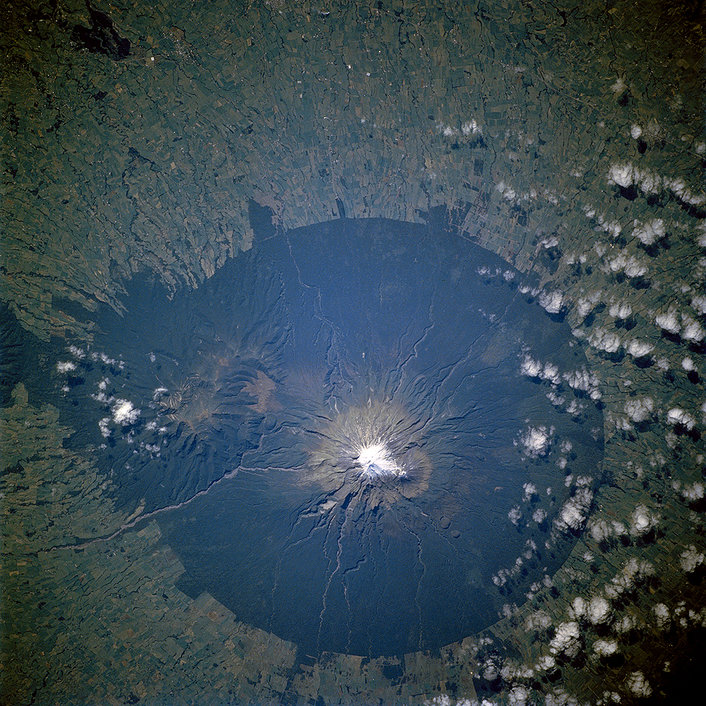
Egmont National Park Boundary

The boundaries of Egmont National Park were set at a six mile radius from the peak, and the forest has been cleared for farming right up to the park borders, so entering the park is like driving through a wall of rainforest. Photo credit: NASA.

Ruakuri Cave

Posted from Egmont National Park, New Zealand at 12:14 pm, April 11th, 2024

Spellbound Cave is still my favorite cave for glowworms, but Ruakuri Cave has joined it on my list of all time favorite caves anywhere in the world.

I wasn’t sure what to expect from Ruakuri Cave, but I ended up loving it. It wasn’t overdeveloped, there weren’t any other people aside from our group, and the formations were largely undamaged. More impressively, it was FULL of large stalactites, stalagmites, abysses, underground rivers, and narrow passages that made it really fun to explore. Our group was only six people (apparently the normal size is sixteen but since it was a late season and early morning tour it didn’t fill up), which felt almost like a personal tour of the cave. There were a handful of glowworms in the cave, but it was the cave itself that was the star of this tour. There were a bunch of highlights, but standing on a metal catwalk in a massive passageway with the cave ceiling several stories above, and then having the guide point a light downwards into the blackness and realizing we were suspended in the air several stories above an underground river, was a pretty cool moment and not something I’ve ever experienced before.

After the ninety minute tour I left Waitomo, heading west through the hills, stopping briefly at an undeveloped cave that required a ten minute hike through the forest. I had this roadside cave all to myself, aside from a number of six-inch long wetas (cave crickets) that seemed annoyed anytime I shined a light in their direction. The remainder of the drive was through more hills and pastures before eventually turning south along the coast.

The plan for tomorrow was originally to hike the 19 kilometer Pouakai Crossing across the slopes of the Mount Taranaki volcano, but the weather is being disagreeable, so barring a minor miracle I’m going to call an audible and see what else is feasible given the wind and wet stuff. At present, despite being only a few miles away from it, I’ve yet to actually see the picturesque 8,261 foot tall volcano since it’s hiding behind clouds, but hopefully it will peek out at some point before it’s time to move on.

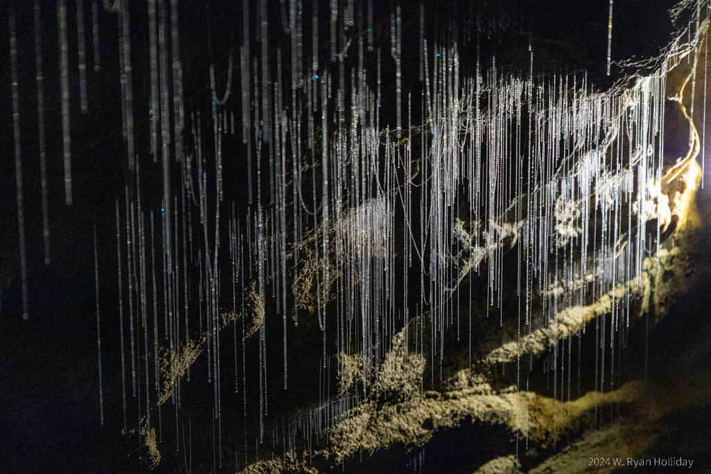
Glowworm Threads, Ruakuri Cave

Glowworm threads in Ruakuri Cave. Our guide this time was a part-time filmmaker, which meant he was excellent with lighting scenes for us during the tour.

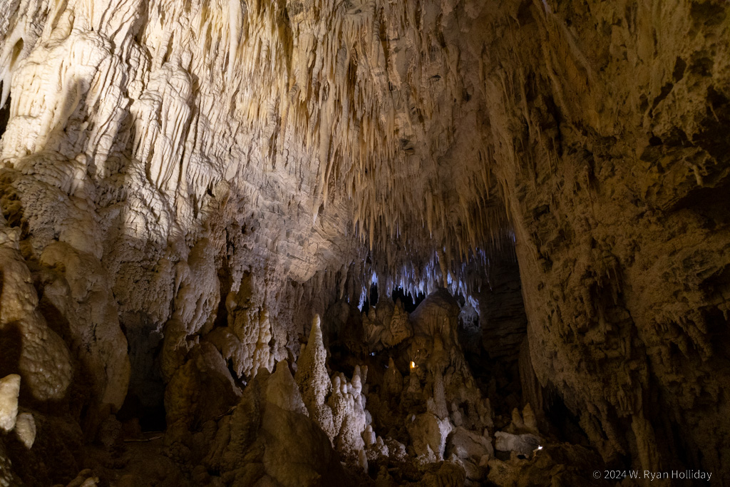
Cave Formations, Ruakuri Cave

Cave formations in Ruakuri Cave.

Glowworms

Posted from Waitomo Caves, New Zealand at 11:47 am, April 10th, 2024

The town of Waitomo is famous for having hundreds of caves, but even more famous for the glowworms that inhabit many of those caves. While you can see glowworms above ground in a number of places in New Zealand, there’s something very special about being in a cave illuminated solely by the light of thousands of tiny insects.

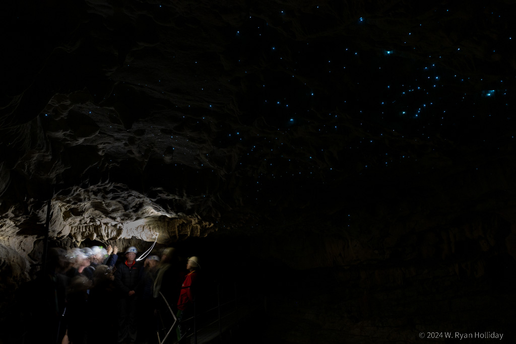
There are a few companies offering glowworm tours, and I scheduled trips with both Spellbound Tours and with the very popular Waitomo Glowworm Tours, the company that originated these trips more than 100 years ago. While Waitomo Tours had the better cave, Spellbound had the better glowworm experience. Spellbound’s cave is relatively short, but we went in with just a dozen people, walked a bit to get our eyes adjusted to the dark (photo below), then took a magical, no-photographs-allowed boat trip up and down an underground river with tens of thousands of glowworms lighting the place up and reflecting in the water. It was a scene straight out of the movie Avatar, and we got a good long while to enjoy it. Following that trip Spellbound took us to another cave that had many fewer glowworms, but a ton of stalactites and stalagmites to enjoy.

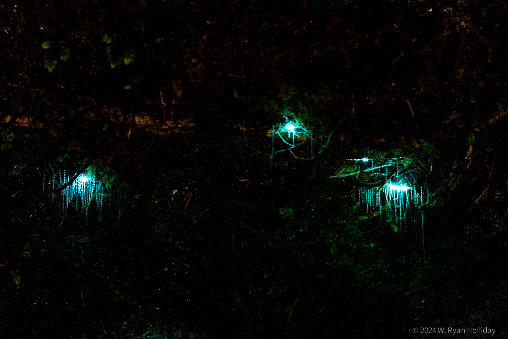
For the afternoon I booked one of the last trips of the day with Waitomo Glowworm Tours on their main cave tour, hoping that all of the tour buses would be gone, and that worked out well since it ended up being a less-crowded experience than most groups get. The cave was bigger and the cave formations were more impressive, but it felt more commercial and busy than the morning trip, and while it was still really, really neat, it didn’t have quite the same magic as the morning tour. Finally the day of many glowworms ended after sunset with a trip to the glowworm grotto next to my cabin, and I got to finish the day with a fern-covered cliff and its many hundreds of glowing bugs all to myself. Unfortunately photography today was a bit tricky since it’s hard to manually focus on a fly larvae in the darkness, but the two photos below hopefully give some sense of what it was like.

Tomorrow I’ve got a trip to one more glowworm cave, then it’s off to the impressive volcano of Egmont National Park. There’s a massive storm blowing up from the south, so odds are that the next few days may be the first bit of the trip to get rained out, but we’ll see if the weather gods decide to intervene and provide dry trails.

Spellbound Cave

Glowworms in Spellbound Cave, with the tour group on the left. This 30-second exposure was taken underground, not under the stars.

Waitomo Glowworms

Close up of glowworms and their sticky strands from a grotto next to my cabin.