Ryan's Journal

"My life amounts to no more than one drop in a limitless ocean. Yet what is any ocean, but a multitude of drops?" — David Mitchell

Moving Right Along

Posted from Coromandel Peninsula, New Zealand at 11:50 am, April 18th, 2024

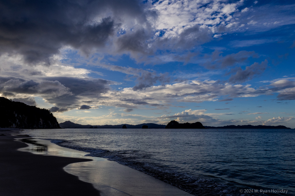
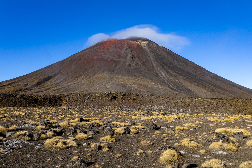
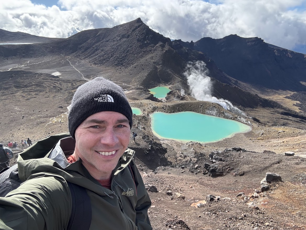
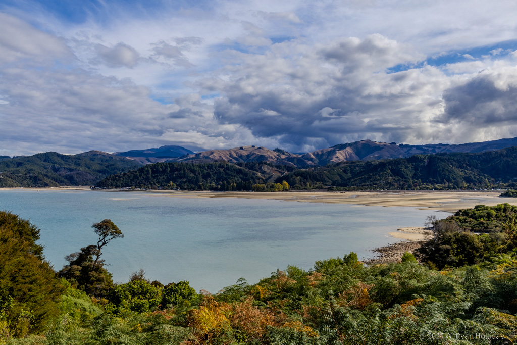
Today was a day of much driving, with a couple of short breaks along the way. Before leaving Rotorua, the lady who ran the B&B suggested I should do the hike up Mount Maunganui, a 750 foot tall dormant volcano on the coast. Never one to pass up climbing dormant volcanoes, I stopped on my way and hiked several miles up and around the big rock, taking in some rather inspiring views of the Pacific from the top. From there it was off to the Coromandel Peninsula, which is mostly farms, hills and oceans, providing some nice flashbacks to the rural scenery of the South Island. It was getting late in the day as I got to the town of Hahei, and while the trail to their famous Cathedral Cove was closed due to damage, the view from Hahei Beach as the sun was getting low on the horizon wasn’t half bad.

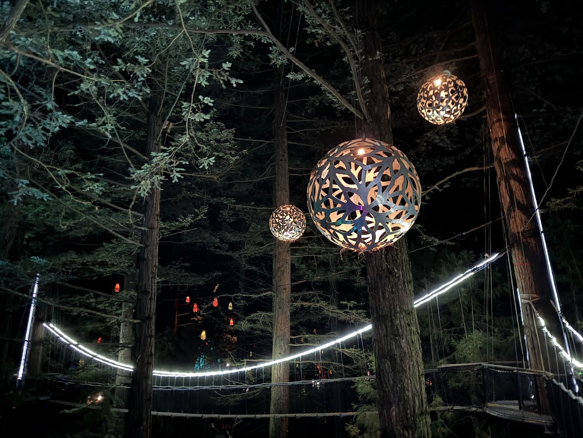
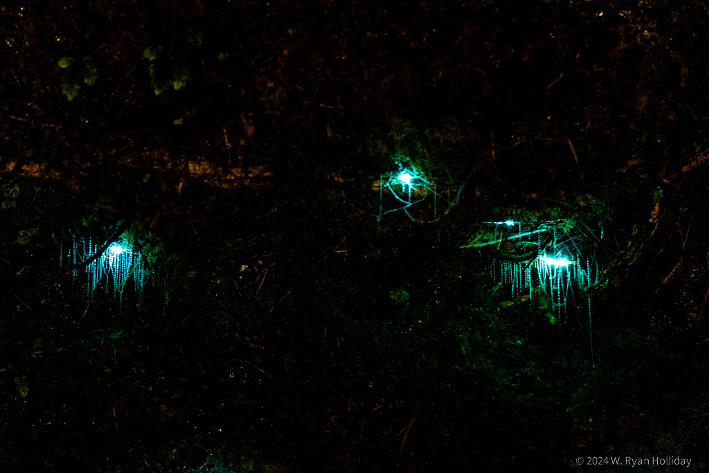
Tonight’s lodging is at the Buffalo Lodge, and I’ve got this huge place all to myself after a large group apparently cancelled due to Covid. It’s way up in the hills surrounded by forest, and I’m hearing a few nocturnal birds having some sort of cocktail party outside. I was hoping they might be New Zealand’s famous kiwis, but while there are supposedly kiwis around here, an interweb search for kiwi calls says the current party chatter is coming from something else – the closest match I’ve found so far is the morepork, a tiny native owl, and if that’s who’s out there talking he has a LOT to say.

Tomorrow I’m driving back through Auckland on my way further north, and despite living in Los Angeles I’ve become very afraid of traffic and people over the past month of travel, so send thoughts and prayers as I navigate highways and traffic lights again.

Sunset, Hahei Beach

Late in the day at Hahei Beach, with a few happy little clouds.

Bubble Geysers

Posted from Rotorua, New Zealand at 12:40 pm, April 17th, 2024

Today had by far the strangest start to any day of the trip so far, but things improved greatly from that point.

After breakfast I drove 30 minutes to the Wai-O-Tapu Thermal Wonderland, with no expectations whatsoever as to what I might encounter. They advertise that the Lady Knox Geyser erupts daily at 10:15am, which had me confused as to whether it was an actual geyser, and if so then how it could erupt at the same time each day. As it turns out, the geyser was accidentally discovered by convicts from a labor camp who saw a hot pool, decided to wash in it, and when the water got a bit soapy it induced a geyser eruption, scaring the hell out of them and causing them to run buck naked back to their camp. Today, following the lead of those convicts, park employees walk out to the geyser each morning at 10:15 while surrounded by an amphitheater full of tourists, dump a bag of soap into the cone to induce an eruption, and then begin playing music over speakers as the eruption commences with tons of soap bubbles bursting forth from the geyser like it’s a kid’s science fair experiment. Eventually the eruption turns from soapy to steamy to hot water shooting fifty feet into the air, but bubbles continue to float through the surroundings the entire time. I suppose it’s the only way to show people a predictable geyser eruption, but it still felt very, very odd. Apparently the geyser usually erupts for about an hour, but today the show lasted only about a minute, which made the experience even more of an inauspicious start to the day.

After the geyser eruption I headed over to the park’s trails, and they turned out to be much, much more normal than expected after the earlier soapy spectacle. The thermal features were all totally natural, they had a bunch of impressive mud pots and silica terraces, there were hot springs of all sorts of vibrant colors, really good and informative signage about the Taupo supervolcano, and I spent a very pleasant two hours roaming the area.

Things improved further with an afternoon journey to the Waimangu Volcanic Valley, an area formed after the 1886 eruption of Mount Tarawera. The visit is via trails through rainforest, leading past features like Frying Pan Lake, the world’s largest hot spring, and it was a nice hike with very few people around. Of particular note, the area was home to the world’s largest geyser from 1900 until 1904. The Waimangu Geyser erupted every 36 hours for 5-6 hours at a time to heights of over 400 meters, which is taller than the Empire State Building. For comparison, the largest active geyser today is Steamboat Geyser in Yellowstone, which erupts to a height of 90 meters, while Old Faithful erupts to a height of about 40 meters. As with many thermal features, earthquakes and continuing volcanic activity eventually changed the underground plumbing of the system, and the Waimangu Geyser was declared to be extinct in 1908.

Tomorrow I’m heading to the coast and up to the Coromandel Peninsula. Somehow it’s down to the last ten days in New Zealand, but there’s some diving coming up next week that should make them very memorable days.

Frying Pan Lake, Waimangu Volcanic Valley

Frying Pan Lake, the largest hot spring in the world.

New Zealand Red Admiral

A New Zealand Red Admiral who decided to pose for pictures for a couple of minutes while I was hiking today.

Great Expectations

Posted from Rotorua, New Zealand at 12:04 pm, April 16th, 2024

I make it a general rule to try to keep expectations low; if you expect something to be the best experience of your life and it’s merely great then you’re inevitably disappointed, whereas if you expect something to be good and it’s great then you’re pleasantly surprised. However, somehow, somewhere, I had gotten it into my head that New Zealand’s geothermal features rivaled Yellowstone. I’m not sure how that happened, but when I initially circled Rotorua as a must-visit place on the itinerary I figured I’d be walking through the Southern Hemisphere’s version of Norris Geyser Basin and taking shots of the Kiwi Grand Prismatic Hot Spring. Orakei Korako Geothermal Park is generally listed as the best of the area’s geothermal parks, and I enjoyed getting to visit everything from silica terraces to mud pots, but it would have been one of those places that most people passed by without stopping on their way to see Old Faithful in Yellowstone. I also took a walk around town and saw some of the steam vents along Lake Rotorua, but again, with expectations set to Yellowstone levels, a few steaming pools were neat to see but not what I had been anticipating.

So thus it was that I headed to my lodging for the evening, thinking that this would go down as one of the merely “OK” days of the trip. After checking in the lady who runs the place mentioned that there’s a treewalk with nighttime illumination in the nearby redwood forest (quick history: 150 years ago New Zealanders planted thousands of trees of different species, including a large redwood forest, to see what might grow well and support a timber industry). California is where redwoods are native, and they are much older and larger at home than the ones here, so I was lukewarm to the idea of an after-dark treewalk, but my primary mission over this three month trip is to have adventures and see beautiful things, and you can’t do that from a hotel room, so just after sunset I walked a kilometer to the forest, handed them a ticket, and ascended 30 feet into the trees.

It was amazeballs.

Proving again that expectations can make or break an experience, I spent two hours enjoying 800 meters of bridges and platforms suspended from redwoods, all of them 10-20 meters above the ground. Huge lanterns hung from branches to provide soft illumination in the treetops, LED lights lit up ferns on the ground, lasers made corners of the forest look like they were filled by ten thousand fireflies, and other effects made a redwood forest feel like a perfect blending of art and nature. The bridges and platforms shook with each step and provided a unique perspective on the trees. What might have otherwise been a lackluster day ended on a high note, and I got an experience unlike anything I’ve done before.

Tomorrow I’m thinking of visiting another geothermal park, this time with very low expectations, and beyond that we’ll see what other surprises New Zealand manages to serve up.

Boiling Mud, Orakei Korako

Boiling mud in Orakei Korako.

Redwood Treewalk, Rotorua

Rotorua redwood nighttime treewalk, 20 meters up in the air. Photo taken with my iPhone since the platforms were too shaky for nighttime photography with the Canon.

Tongariro Alpine Crossing

Posted from Turangi, New Zealand at 11:45 am, April 15th, 2024

Today’s hike was a one-way, 20 km trek across two volcanoes with a bit over 2000 feet of elevation gain. Since it’s a one-way trip, nearly everyone who does it takes a shuttle, and as he dropped us at the trailhead just after 7am our driver cheerfully told us “Sorry guys, that’s as far as I’m allowed to take you, you’ll have to walk the rest of the way.”

By far, the most scenic section of the trail is the volcanic crater at the top with its blue-green pools, and with the weather forecast suggesting that there might only be a couple of hours cloud-free at the summit, I decided to power up as fast as I could. With temperatures in the high 30s / low 40s I ditched my jacket and hiked at a brisk pace in just a long-sleeved shirt. I sweat like a pig at the slightest exertion, so climbing up stairs and over rocks there was a cloud of steam surrounding me as I made me way up, but emitting clouds of steam on a volcano has a certain logic to it. Luckily I got to the top in about two and a half hours with mostly-blue skies and had an hour to enjoy it before clouds started pouring over the summit and obscuring the scenery. Underscoring how important good weather is for this hike, as I was leaving the crater and clouds were reducing visibility to just tens of meters, I overheard someone else saying to his partner “Is this supposed to be the highlight?”. I owe the karma gods big time for my luck on this trip.

Having gotten to the top during today’s tiny window of clear weather I took a few photos, had lunch, roamed around a bit, and then had a leisurely stroll for the remainder of the hike. The hike overall was a fun one. You start with views of Mount Ngauruhoe (Mount Doom for Lord of the Rings fans) and hike up the bottom slopes of that volcano. Since it’s a popular trail, the Department of Conservation seems to do everything possible to dissuade people from continuing, including numerous “turn around if…” signs and a large sign at the top of the first steep climb that says “That was the easy part, it’s MUCH harder ahead”. Despite admonitions against continuing, the views get better as you climb, and after passing Mount Ngauruhoe and ascending to the top of Mount Tongariro it’s other-worldly hiking across a giant volcanic crater, with steaming fumaroles, lakes and pools that are colors that shouldn’t be possible outside of cartoons, and moonscapes of flat, rocky plains. The downhill was scenic as well, with views for miles out over the massive Lake Taupo and the surrounding countryside. I didn’t have perfect weather today, but it was pretty damn good for most of the hike and made for a grand adventure.

After the long and leisurely hike down it was only 2:30pm, so I figured why not do another short hike (I’m an idiot), and after hiking with hundreds of other people on the crossing figured an easy 6 km stroll around Lake Rotopounamu might be quieter (it was). Tomorrow it’s sadly time to move on again, but it’s only a short hop over to Rotorua, which is New Zealand’s most famous geyser and thermal area.

Mount Ngauruhoe, Tongariro Alpine Crossing

Mount Ngauruhoe, which played the role of Mount Doom in the Lord of the Rings.

Tongariro Alpine Crossing Self-Portrait

Self-portrait above the crater of Mount Tongariro. Surprisingly the pools in the background were freezing cold, even with steaming fumaroles around them.

Tama Lakes

Posted from Turangi, New Zealand at 10:46 am, April 14th, 2024

It turns out that there is still a sun up there.

The wet stuff mostly stopped for the day today, and while clouds still partially obscured the views, after four days of rain, when I saw blue sky this morning I was amped up like a puppy ready to go for his walk. With the 20 kilometer Tongariro Alpine Crossing scheduled for tomorrow, I decided to warm up for it with the 18 kilometer Tama Lakes Track today. I haven’t gotten to go hiking in a few days, so while a smarter man might have taken it easier today, I am not such a man.

The hike was a good one. The elevation change wasn’t too bad, it traversed some neat alpine scenery, and it ended up at a high ridge with a view of the two aqua blue lakes. Various volcanic peaks occasionally also partially appeared from the clouds, hinting at some next-level glorious scenery, but the clouds never quite parted enough to get a sense of what it must be like on a perfectly clear day.

Tomorrow it’s off on what is generally regarded to be New Zealand’s best day-hike. It won’t be perfect weather, but I’m excited to be able to at least get out there and do it after such a long stretch of rainy days.

Lower Tama Lake, Tongariro National Park

Lower Tama Lake, Tongariro National Park. Both lakes formed inside of volcanic explosion craters, and two large volcanoes were looming on the horizon, partially obscured behind the clouds.

The Forgotten World Highway

Posted from Turangi, New Zealand at 11:57 am, April 13th, 2024

New Zealand’s marketing department is pretty good with naming. In another journal entry I mentioned how they’ve labeled ten hikes throughout the country as “Great Walks”, which of course makes you want to give them a try. Similarly, while leaving Auckland, I was greeted with highway signs for the “Thermal Explorer Highway”, which traverses several geothermal areas, and who doesn’t want to be a thermal explorer? Today I had several options to get from Egmont National Park to Tongariro National Park, but with one of those routes labeled as the “Forgotten World Highway” the choice was clear. Unfortunately the rain continued all day, so views were limited and I didn’t get out of the car much, but it was a neat route through an area of New Zealand that didn’t really get a functional road until the 1960s and doesn’t seem to see many visitors.

Of particular note along the way was the town of Whangamōmona, which is most famous for having declared itself the Republic of Whangamōmona during a dispute over regional boundaries in 1989. While this was more of a protest than an actual rebellion, they nevertheless immediately elected as President a resident who had been put on the ballot without his knowledge, and who served from 1989 until 1999. In 1999 he retired, and President Billy Gumboots, a goat, was elected and served for 18 months until he died in office. The next election resulted in President Tai the Poodle, who held office for a year. Elections continue to be held every two years, and recent votes have resulted in human Presidents, although a mannequin won a close second place in 2023 and was installed as VP.

There are hushed whispers that the sun hasn’t actually burned out and will reappear at some point tomorrow, so I’ve booked a permit and shuttle for the Tongariro Crossing for Monday morning (two days from now), and will hopefully be able to do the hike in reasonably dry weather with at least some views of the scenery. In the mean time I think the plan for tomorrow will be to try a shorter hike in the park, assuming our nearest star actually chooses to once again break through the rain clouds that have been here for several days now.

Invisible Volcanoes

Posted from Egmont National Park, New Zealand at 11:49 pm, April 11th, 2024

As expected it rained all night and all day, and despite spending two hours driving the circumference of Egmont National Park, including driving up to two of the visitor centers, I still haven’t seen any of the 8,261 foot tall Mount Taranaki. Were it not for the fact that there’s a massive mountain on the map I would easily believe that there’s nothing but farmland and rolling hills in this area, but rumors persist that one of the world’s most picturesque volcanoes is hiding in the clouds just a few miles away.

I expected a few storms on the trip, and while it’s a bummer to miss out on the Pouakai Crossing, it was a roll of the dice spending only a day here to try to traverse it; six weeks seems like a long time for a visit to New Zealand, but it’s a laughably insufficient amount of time when you want to see everything. After leaving Egmont National Park I’ve planned for three nights near Tongariro National Park for the Tongariro Alpine Crossing since that’s the hike I most want to do, so with luck the weather will clear and I’ll get a chance to do arguably New Zealand’s most scenic day-hike without the need for a wetsuit and sonar.

As three inches or so of rain have fallen over the past 24 hours, causing Mount Taranaki to go missing, I was reminded of a story that John Rhys-Davies (Gimli) told about filming during the Lord of the Rings. They were near Queenstown shooting some lake scenes when a huge storm came in, roads were cut off due to landslides, and he had to use a stepladder to get into his hotel room through a window due to flooding. In the midst of this storm, the production coordinator made the rare call to cancel shooting, stating that “we cannot shoot tomorrow because the lake is underwater.”

Egmont National Park Boundary

The boundaries of Egmont National Park were set at a six mile radius from the peak, and the forest has been cleared for farming right up to the park borders, so entering the park is like driving through a wall of rainforest. Photo credit: NASA.

Ruakuri Cave

Posted from Egmont National Park, New Zealand at 12:14 pm, April 11th, 2024

Spellbound Cave is still my favorite cave for glowworms, but Ruakuri Cave has joined it on my list of all time favorite caves anywhere in the world.

I wasn’t sure what to expect from Ruakuri Cave, but I ended up loving it. It wasn’t overdeveloped, there weren’t any other people aside from our group, and the formations were largely undamaged. More impressively, it was FULL of large stalactites, stalagmites, abysses, underground rivers, and narrow passages that made it really fun to explore. Our group was only six people (apparently the normal size is sixteen but since it was a late season and early morning tour it didn’t fill up), which felt almost like a personal tour of the cave. There were a handful of glowworms in the cave, but it was the cave itself that was the star of this tour. There were a bunch of highlights, but standing on a metal catwalk in a massive passageway with the cave ceiling several stories above, and then having the guide point a light downwards into the blackness and realizing we were suspended in the air several stories above an underground river, was a pretty cool moment and not something I’ve ever experienced before.

After the ninety minute tour I left Waitomo, heading west through the hills, stopping briefly at an undeveloped cave that required a ten minute hike through the forest. I had this roadside cave all to myself, aside from a number of six-inch long wetas (cave crickets) that seemed annoyed anytime I shined a light in their direction. The remainder of the drive was through more hills and pastures before eventually turning south along the coast.

The plan for tomorrow was originally to hike the 19 kilometer Pouakai Crossing across the slopes of the Mount Taranaki volcano, but the weather is being disagreeable, so barring a minor miracle I’m going to call an audible and see what else is feasible given the wind and wet stuff. At present, despite being only a few miles away from it, I’ve yet to actually see the picturesque 8,261 foot tall volcano since it’s hiding behind clouds, but hopefully it will peek out at some point before it’s time to move on.

Glowworm Threads, Ruakuri Cave

Glowworm threads in Ruakuri Cave. Our guide this time was a part-time filmmaker, which meant he was excellent with lighting scenes for us during the tour.

Cave Formations, Ruakuri Cave

Cave formations in Ruakuri Cave.

Glowworms

Posted from Waitomo Caves, New Zealand at 11:47 am, April 10th, 2024

The town of Waitomo is famous for having hundreds of caves, but even more famous for the glowworms that inhabit many of those caves. While you can see glowworms above ground in a number of places in New Zealand, there’s something very special about being in a cave illuminated solely by the light of thousands of tiny insects.

There are a few companies offering glowworm tours, and I scheduled trips with both Spellbound Tours and with the very popular Waitomo Glowworm Tours, the company that originated these trips more than 100 years ago. While Waitomo Tours had the better cave, Spellbound had the better glowworm experience. Spellbound’s cave is relatively short, but we went in with just a dozen people, walked a bit to get our eyes adjusted to the dark (photo below), then took a magical, no-photographs-allowed boat trip up and down an underground river with tens of thousands of glowworms lighting the place up and reflecting in the water. It was a scene straight out of the movie Avatar, and we got a good long while to enjoy it. Following that trip Spellbound took us to another cave that had many fewer glowworms, but a ton of stalactites and stalagmites to enjoy.

For the afternoon I booked one of the last trips of the day with Waitomo Glowworm Tours on their main cave tour, hoping that all of the tour buses would be gone, and that worked out well since it ended up being a less-crowded experience than most groups get. The cave was bigger and the cave formations were more impressive, but it felt more commercial and busy than the morning trip, and while it was still really, really neat, it didn’t have quite the same magic as the morning tour. Finally the day of many glowworms ended after sunset with a trip to the glowworm grotto next to my cabin, and I got to finish the day with a fern-covered cliff and its many hundreds of glowing bugs all to myself. Unfortunately photography today was a bit tricky since it’s hard to manually focus on a fly larvae in the darkness, but the two photos below hopefully give some sense of what it was like.

Tomorrow I’ve got a trip to one more glowworm cave, then it’s off to the impressive volcano of Egmont National Park. There’s a massive storm blowing up from the south, so odds are that the next few days may be the first bit of the trip to get rained out, but we’ll see if the weather gods decide to intervene and provide dry trails.

Spellbound Cave

Glowworms in Spellbound Cave, with the tour group on the left. This 30-second exposure was taken underground, not under the stars.

Waitomo Glowworms

Close up of glowworms and their sticky strands from a grotto next to my cabin.

Dinner at Hobbiton

Posted from Waitomo Caves, New Zealand at 1:15 pm, April 9th, 2024

The first ten hours of the day yesterday were fun but less exciting than the evening. First, I woke up early and headed out of Auckland as fast as the two hamsters that power the Suzuki’s engine would take me. After a few errands I hiked up to a lookout in the Hakarimata Scenic Reserve that claims to have 1500 stairs, but I’m pretty sure they counted both up and down. Finally, to kill a couple of hours I visited the Hamilton Gardens and was surprised by how nice it is; they’ve created themed gardens such as “English Garden”, “Italian Renaissance Garden”, “Egyptian Garden”, etc that were all very different and fun to walk around. And then it was time to go to Hobbiton

Hobbiton is literally the most touristy thing you can do in New Zealand. Supposedly 300,000 people each year take a tour through the place, but I gotta say, it’s incredibly well done. The artists who created this permanent film set absolutely went all out, and every little detail is like being inside of an art installation. The wooden frames of the Hobbit hole doors are pegged together as if built before modern tools, the firewood is cut in Hobbit-sized pieces, there are intricate carvings on most of the wooden beams, the thresholds under the doors are worn as if from years of use, and in one of the Hobbit holes that you can walk through they’ve even marked up one of the beams with the heights of the Hobbit children as they grew each year, just like we did when we were kids. There literally must have been tens of thousands of hours that went into creating this place, and you can’t help but be impressed by how they obsessed over the details, and how well they pulled off creating a living, breathing Hobbit village on a working sheep farm.

Four times a week they offer an evening banquet tour with a “feast fit for a Hobbit”, and after three weeks of often forgetting about lunch or dinner, I didn’t realize how much food I was prepared to pack away. At dinnertime they pulled back the curtains at the Green Dragon’s dining room to unveil tables completely covered in beef stew, roast chicken, legs of lamb, salmon, sausages, roasted vegetables, etc, and by my fourth helping an old lady at the table looked at me, laughed heartily, and said “that’s how it should be done”. Following dinner and an equally impressive dessert spread they handed everyone a lantern, and we set off in the dark back through Hobbiton with the Milky Way blazing overhead and Hobbit holes lit as if evening fires were burning inside. Again, it was as touristy a thing as you can possibly do in New Zealand, and I loved every minute of it.

Hobbiton

First view when you arrive at Hobbiton, looking up at Bag End on the hill in the distance. There is a large team of gardeners that work here that keep all of the flowers and vegetables looking their best.

Hobbiton

Samwise Gamgee’s House. Everything is made from real materials: brick, wood, stone, slate, glass, etc.

The Big Smoke

Posted from Auckland, New Zealand at 9:55 am, April 8th, 2024

Today started with the sounds of fur seals at sunrise and, for the first time in three weeks, ended with the sounds of cars in rush hour traffic.

As planned, I got up before dawn this morning and headed out to Kaikoura’s seal colony. Just as I’d hoped, no one else was there and the seals hadn’t yet retreated from the walking paths, so it was a landscape of pinnipeds around every corner as the sun peeked above the horizon. To my surprise, with the exception of one jogger no one else showed up for the entire time that I was there, so it was just a few hundred sleepy, ornery fur seals with a bald guy talking to them, while waves were crashing, the soft light was brightening, and the tide was retreating.

Since I had a plane to catch, and since Christchurch was still two and a half hours south, I had to leave sooner than I would have liked, but it was a pleasant drive along the coast and through pastures and farmland back to town. It was a bit of a shock to the system to see traffic lights again in Christchurch, but nothing compared to what awaited in Auckland. The flight was uneventful, I got to Auckland and picked up my car (a Suzuki… we have a mixed history, so we’ll see how the next three weeks go…), and then departed for my hotel. Google maps showed everything red, the highway was three lanes of often impatient drivers, and it was a rude reminder that the past three weeks have been spent far away from the masses.

Tomorrow I’ll almost certainly be leaving early to escape from the city, and the destination is one that I’m (embarrassingly) super-excited about: dinner is at the Green Dragon Inn, and I’m definitely going to take a selfie at Bilbo’s House.

Fur Seal, Kaikoura

This ferocious little guy is my newest friend in New Zealand. He scowled and barked at me for two minutes, then decided to ignore me completely and go back to sleep.

New Zealand South Island Itinerary

My approximate route around the South Island over the past three weeks. According to the rental car company I covered 3188 km (1981 miles).

Albatross Watching

Posted from Kaikoura, New Zealand at 12:04 am, April 7th, 2024

New Zealand apparently has daylight savings time. I was utterly baffled this morning at how the sun had been coming up at 8am on the west coast but came up at 7am here, and why I was so wide awake at 6am. It wasn’t until much later in the day when I noticed sunset was at 6pm, while it had definitely been around 7pm yesterday, that I realized a) I was more intelligent when I was younger and b) America isn’t the only country to unnecessarily mess about with everyone’s sleep schedule.

As a result of the time change the 7:15am checkin for the whale watch trip didn’t feel early at all. We were on the water by 8am, but since we were the first boat of the day we had to find the whales. The crew would stop the boat, shut off the engines, drop a hydrophone, listen for whales, pull up the hydrophone, and then move on after announcing they didn’t hear any whales, but that was fine by me – I cared less about the whales and was more excited just to be on the water. There were a ton of fur seals, dolphins, and albatross out and about, and while it would have been nice to see a sperm whale, you can’t go wrong being on the ocean in perfect conditions.

After one last listen for whales we started heading back to harbor, dolphins surfing on the bow wave, when a call came in that there was a humpback near shore. Since they refund 80% of the trip cost for any trip that doesn’t find whales the crew was motivated to find the humpback, and we did eventually stumble on him, but only had a couple of minutes with the whale before we had to get back to pick up the next group. Despite having seen a whale, the company apparently felt that this wasn’t a good enough sighting, and still refunded the bulk of the trip price for everyone – if ever you’re in Kaikoura, go whale watching with Whale Watch Kaikoura, they gave us a great day on the water and then honored their “whale guarantee” because the whale experience we had didn’t meet their expectations.

Following the whale watch and a shockingly inexpensive seafood lunch from the Kaikoura Seafood BBQ Kiosk, the rest of the day was spent hiking along the beach with the grumpy yet highly entertaining fur seals. There are several hundred of them all along the shore here, some playing in the water, most of them sleeping, many of them arguing, but all of them a delight to see. After a few hours with the seals I decided to call it a day early, and am editing photos and writing this entry before sunset (anyone who has traveled with me before knows how rare it is for me to not be doing something whenever it’s light out). The plan for tomorrow is to get up early, make one last visit to the seals at sunrise, and then sadly I’ll be driving down to Christchurch to fly away from the South Island, but I’m excited to start the next part of the adventure on the North Island.

Albatross, Kaikoura

Albatross are incredible in flight, but less graceful launching and landing. This guy had to literally run across the water to generate enough lift for takeoff.

Fur Seals

Posted from Kaikoura, New Zealand at 11:20 am, April 6th, 2024

I ran into the German couple again while I was returning my key this morning; they were apparently staying at the same lodging. At this point it’s starting to feel like that episode of the Twilight Zone where the lady is driving across the country and keeps seeing the same hitchhiker.

After leaving Abel Tasman I stopped at a cafe that had a “world famous sausage rolls” sign out front. I refrained from rushing in and yelling “You did it, congratulations!”, but I did order one, and I gotta say, while I don’t have a lot of sausage roll experience, it was the best one I’ve had.

After saying goodbye to the Germans (again), followed by the famous sausage, it was mostly a driving day, first through the mountains, then through tiny towns and inlets along the northern part of the South Island. At one point the highway turned inland, but an inconspicuous sign reading “scenic route” pointed towards the coast, and luckily I’m not prone to motion sickness because the coastal route was extremely twisty, but also extremely scenic. I made an additional detour to the small harbor town of Picton where ferries depart for the North Island, and eventually made my way south to the town of Kaikoura, visiting another fur seal colony along the way.

Kaikoura is a bit like Monterey (California), with cold, deep waters offshore that attract a ton of marine life. There’s a colony of several hundred fur seals just outside of town, whale watch tours depart daily to see sperm whales, huge pods of dolphins can be seen frolicking along the coast, albatross and petrels glide across the waves farther offshore, and seagulls steal anything left unattended. I booked a last-minute whale watching trip that departs first thing tomorrow, mainly just as an excuse to get out on the water and see the birds and dolphins, although I’m also excited to see a sperm whale since I don’t think I’ve ever seen one before.

Sunrise, Abel Tasman National Park

Sunrise in Abel Tasman National Park. Not a bad sight to wake up to.

Sunset, Kaikoura

Clouds just before sunset in Kaikoura. Days are better when you get to enjoy the sunrise and sunset.

Abel Tasman

Posted from Abel Tasman National Park, New Zealand at 11:02 am, April 5th, 2024

“Hi, my name is Rodney but everyone calls me Rowdy, and I’ll be your skipper today. Go ahead and put your life jackets on, even though we haven’t had a trip that’s needed them since last week.”

And thus began another day in New Zealand.

After a scenic thirty minute boat ride, Rowdy dropped us at Bark Bay, and it was on to the trail. I had expected the Abel Tasman Track would be right along the coast, but it mostly traversed forest, and there weren’t really views of the ocean or beaches for probably 95% of the route, but it was a good walk nonetheless. The weka (ball birds) are utterly fearless here, and I was finding myself eye to eye with them on a few occasions while climbing embankments. One even came over to check me out while I was sitting at an overlook, pecking at my sock before taking a good whack with his beak at my ankle, and while he drew blood I’m confident that I won the fight.

The track wound through forests, across rivers, over estuaries, and past a few beaches, and was a relaxing way to spend the day. I made it back to town about eight hours after starting out, with the iPhone claiming that the total distance covered for the day was about 18 miles.

An odd side note: while at the Wilderness Lodge a few days ago, the only people who joined all of the guided walks were a German couple who spoke limited English. A day after departing from the lodge I was hiking to an overlook at the Franz Josef Glacier, saw the Germans hiking in the opposite direction, and joked with them that they must be following me. Today, in the midst of the forest, the same German couple appeared again; clearly we must have the same travel agent.

Tomorrow I’m on the move again, and sadly there are only a few more days remaining on the South Island before flying up to Auckland to start a circuit on the North Island.

Coastline, Abel Tasman National Park

The end of the Abel Tasman Track. Audrey always gets excited by clouds when she’s taking photographs, now I’m trying to steal one of her photography secrets.

Seals and Cape Foulwind

Posted from Abel Tasman National Park, New Zealand at 11:15 am, April 4th, 2024

It rained all night and through the morning, but when you’re starting your day at Cape Foulwind you sort of want the weather to live up to the name.

First thing today I made a short drive to Tauranga Bay to visit a small fur seal colony. In the midst of a steady rain, the two dozen or so fur seals reminded me of the South Georgia trip; they are playful, loud, and grumpy, but definitely a joy to watch. I didn’t linger since I’m not as waterproof as the seals, and after bidding the pinnipeds adieu I sloshed back into the car to begin the four hour drive to Abel Tasman National Park. I’d been hoping to make some stops along the way, but the rain never really let up so it was a scenic but uneventful drive to the north coast. It finally stopped raining after I arrived, so after checking in to my lodging I roamed around for a bit out on the sand flats as the tide was coming in, apparently annoying a few of the local shorebirds in the process.

New Zealand has ten tramping tracks that have been dubbed Great Walks by the Department of Conservation, and one of them is the Abel Tasman Coast Walk. This trail is actually New Zealand’s most popular hiking track, and while I don’t have time to traverse the full 37 miles, the plan for tomorrow is to have a water taxi drop me at Bark Bay and then enjoy a leisurely stroll back through the first fourteen-ish miles of the walk, ending at the trailhead near my lodging. The weather forecast calls for sun, the tides look like they’ll cooperate so that I can cross the estuary without having to make a long detour, the number of visitors has dropped since it’s late in the season, and I’m looking forward to yet another small adventure in this excellent country.

Pukeko, Abel Tasman National Park

There wasn’t a lot of opportunity for photography today, so while I’d like to stay this Pukeko was captured in the wilds far from humanity, he was actually hanging out with his friends in a horse pasture next to tonight’s lodging.